Winter Storm Chase Season Begins...Canada/United States
Fall is almost here and that means that Winter Storm Chase
Season will soon begin! I am already looking forward to an
active season. Current plans are to photograph New England
Snowstorms, during January and February - see "Upcoming
Events Section." I will be staging in Boston for what
will hopefully be an eventful season. I am also hoping to
photograph a Northern or Central Plains blizzard. I will
be in Quebec City to photograph the
Ice
Hotel during the
Winter Carnival, which will be held in February.
Something new this year will be live blogging - onto this site.
I am also planning on using video for the first time.
So let's ALL HOPE FOR AN AMAZING (and early) WINTER
AHEAD! Let the games begin!
Some highlights from the last couple of years.
My Journal Entry from December 28, 2006
I parked my car, got out, and looked around. I
was in awe at the size of the wet snowflakes falling from above.
They reminded me of one of Walt Disney's creations...a tapestry
come to life. A world of make believe. But this
wasn't make believe...this was real. The air was full of
silence. The only sounds filtering through this quiet
mountain town was the hushed sound of snowflakes hitting the
ground - a testimony to just how large the flakes were. I
could hear myself breathing...wisps of "fog" streaming into the
air as I exhaled into the cold. Occasionally the winter
silence would be broken by a branch snapping under the weight of
the heavy snow. Was I actually standing here...all alone -
in the midst of one of the most beautiful winter landscapes I
have ever experienced?
The trees appeared to have been decorated by an invisible
hand. Garlands of white, laced each drooping branch.
It was as if the town had been decorated for the holiday
season. Beautiful mounds of white could be seen sliding
down the windshields of the vehicles parked alongside the
roadway. Attesting to how wet the snow was. I
laughed as I looked around and thought "this is what the world
would look like if a gigantic shaving cream can exploded."
The crunching of the snow, under my boots, rekindled
memories from my childhood. Those cold winter nights
walking to my grandmothers house on the family farm. The
winter landscape illuminated only by the moonlit cirrus sky and
grandmothers porch light...casting a golden glow across the snow
to light my path along the way. Crunch...crunch...crunch -
I would hurry along - coyotes howling from the back fields.
In my mind I always imagined them closer than they actually
were. I would hurry into her house...removing my coat,
scarf, and gloves I headed straight for her wood stove - full of
burning logs that we had cut earlier in the year. I would warm
my hands from the rising heat. Meanwhile, grandmother would grab
the pop-corn popper - a metal pan with a long handle. The lid
would slide open and we would pour in the popcorn...in a matter
of minutes popping noises filled the little room in the middle
of her house.
It seems like those memories were from just yesterday...but
they were many years ago. Now here I am in Boulder,
Colorado. Standing in the midst of another winter storm. I
remind myself, as I often do, that life is short. Winters
are even shorter. Enjoy the moment...and so I do.
Brrr a cold wind smacks me in the face. I looked
around once again. The scene before me was one straight out of
Charles Dickens Tale. Heavy wet snow blanketed me. I stood there
for a few more moments, I was lost in a daydream. Mesmerized by
the snow. I almost forgot to push the shutter button. After all
that is why I came to Boulder. To photograph this snowstorm.
This one moment in time.
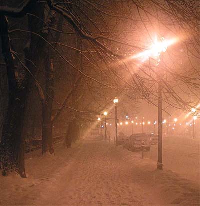
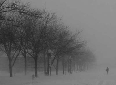
Boston, Massachusetts - Nor'easter 2003
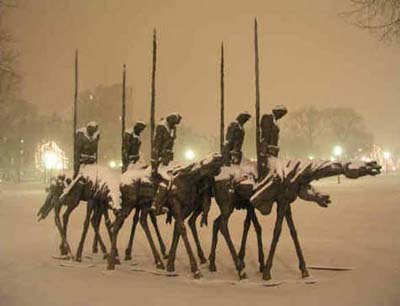
Boston, Massachusetts - Nor'easter 2003
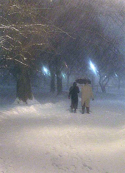
Boston, Massachusetts Snowstorm - 2003
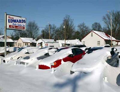
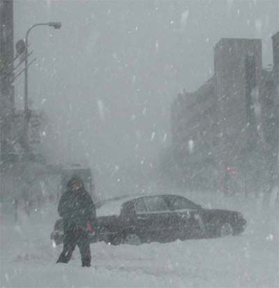
Paducah, Kentucky - Ohio Valley Blizzard 2004
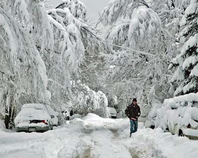
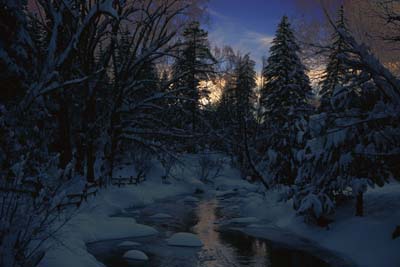
Boulder, Colorado 2006
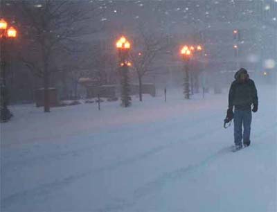
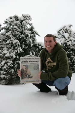
Peoria, Illinois - Winter Storm 2006
Peoria, Illinois Winter Storm 2006
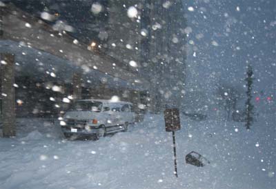
Peoria, Illinois Winter Storm 2006
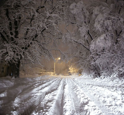
Boulder, Colorado - Winter Storm 2006
Peoria, Illinois Near Blizzard 2006
Colorado Snowstorms 2006
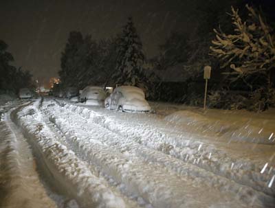
Boulder, Colorado Wet Snow Event 2006
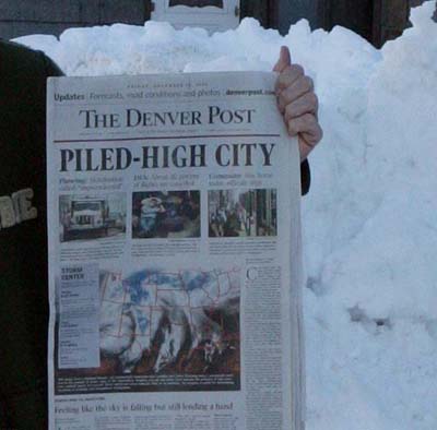
Denver Post - December 2006
Evergreen, Colorado Winter Storm 2006
More photographs, of my recent chases, can be viewed
here on my
photography site. You can also read
analysis of recent events at this location.
____________________________________________________________
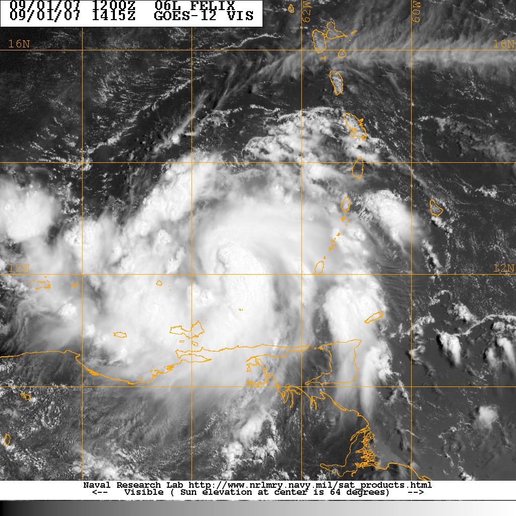
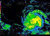
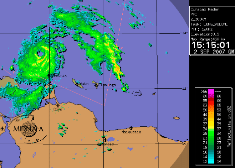
Tropical Storm Felix Forms in the Caribbean...
Felix is moving away from the Windward Islands this morning and
gaining strength. Felix was moving west at 10 mph and will pass
near Aruba over the next 24 hours. Maximum sustained winds were 65
mph and Felix will likely become a hurricane tonight.
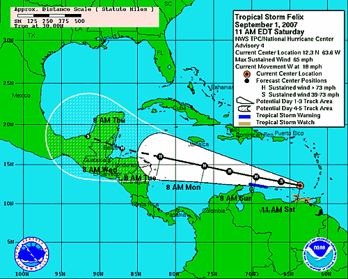
National Hurricane Center Forecast
Track
Gempak Image
Navy Image
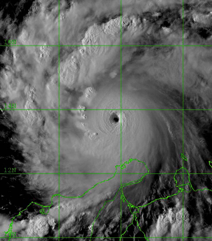
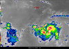
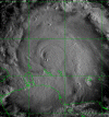
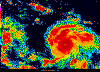
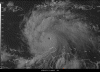
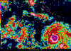
4 PM Satellite
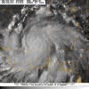
5 PM Satellite - Felix is nearly a hurricane.
Testing the tornado sirens in Paducah...
This was the first time I have actually helped with the testing of
the tornado sirens. I believe I will park a few blocks away next
time!
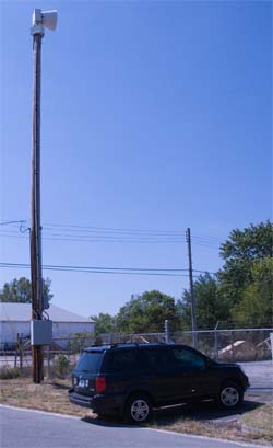
Waiting for the sirens to go off
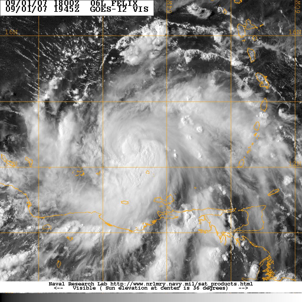
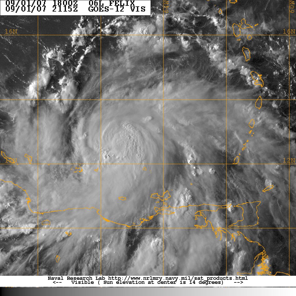
Hurricane Felix...
As expected Tropical Storm Felix has been upgraded to a hurricane.
It has had the appearance of a hurricane for most of the evening.
Winds are now reported at 75 mph.
BULLETIN
HURRICANE FELIX INTERMEDIATE ADVISORY NUMBER
NWS TPC/NATIONAL HURRICANE CENTER MIAMI FL
800 PM AST SAT SEP 01 2007
...FELIX BECOMES A HURRICANE...NEW WATCH FOR JAMAICA...
AT 8 PM AST...0000 UTC...THE GOVERNMENT OF JAMAICA HAS ISSUED A
TROPICAL STORM WATCH FOR JAMAICA. A TROPICAL STORM WATCH MEANS
THAT TROPICAL STORM CONDITIONS ARE POSSIBLE WITHIN THE WATCH
AREA...GENERALLY WITHIN 36 HOURS.
A TROPICAL STORM WARNING REMAINS IN EFFECT FOR THE ISLANDS OF
ARUBA...BONAIRE AND CURACAO. A TROPICAL STORM WARNING MEANS THAT
TROPICAL STORM CONDITIONS ARE EXPECTED WITHIN THE WARNING AREA
WITHIN THE NEXT 24 HOURS.
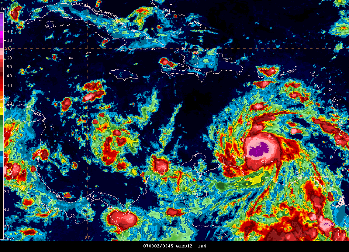
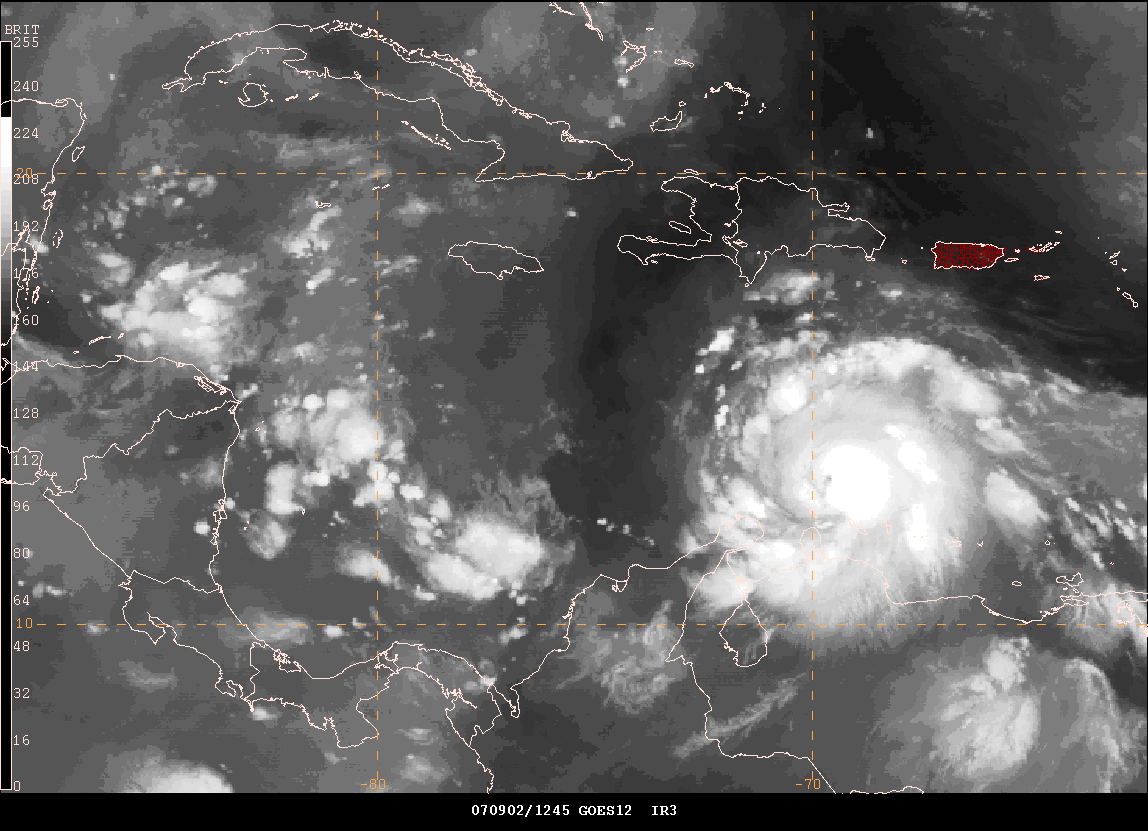
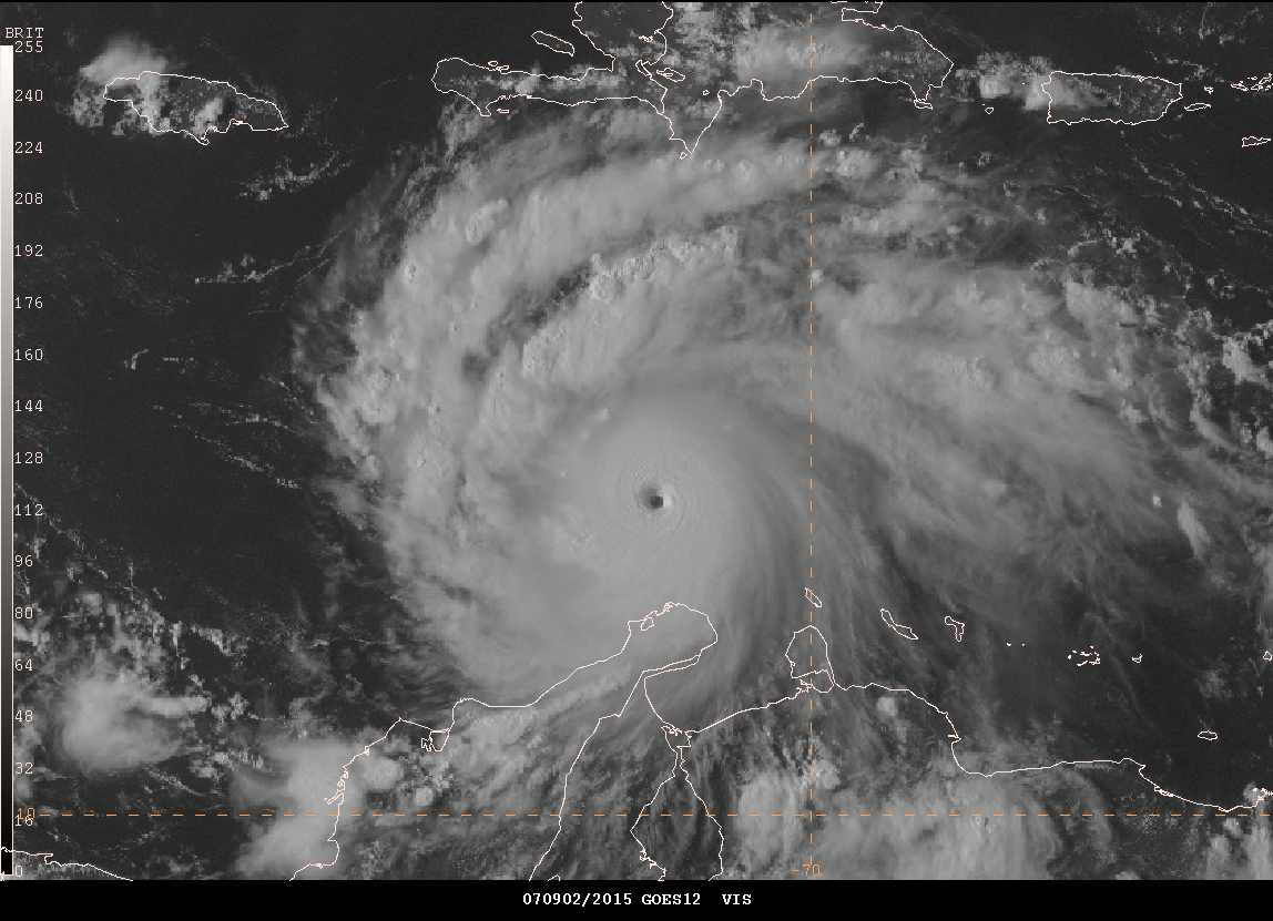
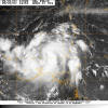
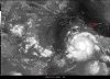
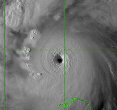
September 2, 2007
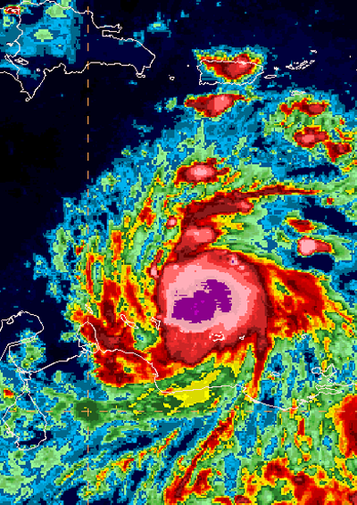
Hurricane Felix at 1 a.m.
Hurricane Felix continues to roll through the Caribbean this
morning with winds of 75 mph with gusts to 90 mph. Felix will
likely continue to strengthen. It is not out of the question that
Felix could become a category three hurricane.
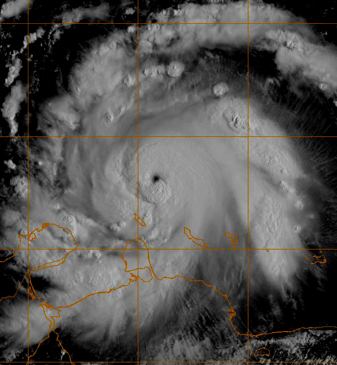
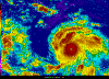
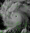
1 AM Satellite
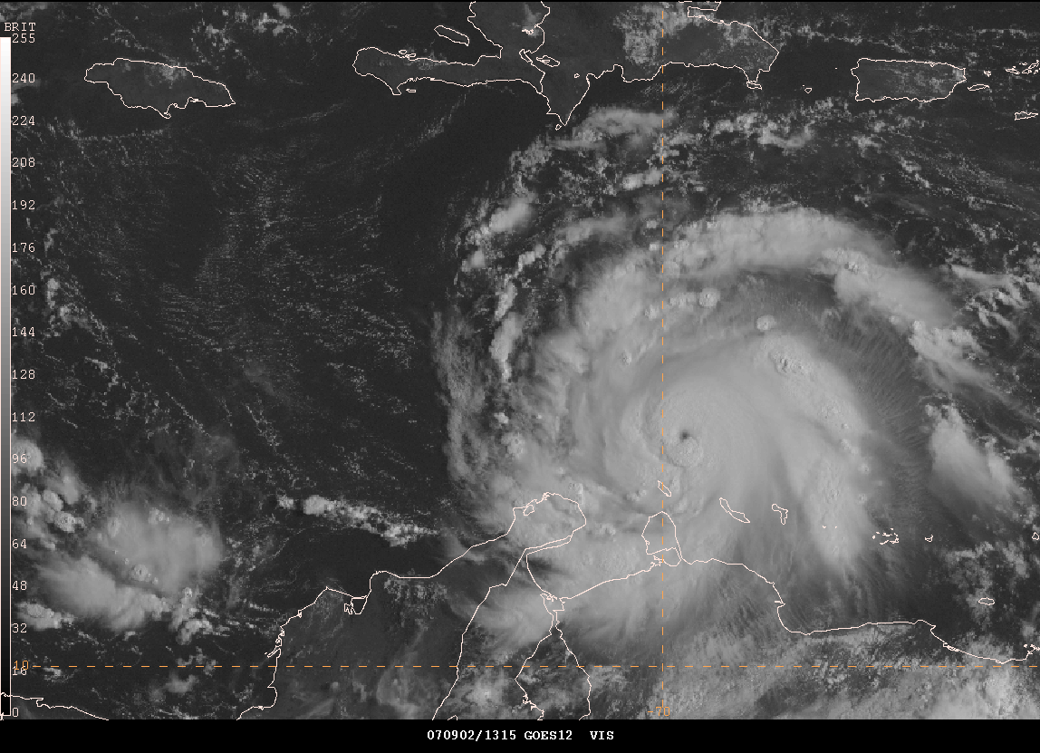
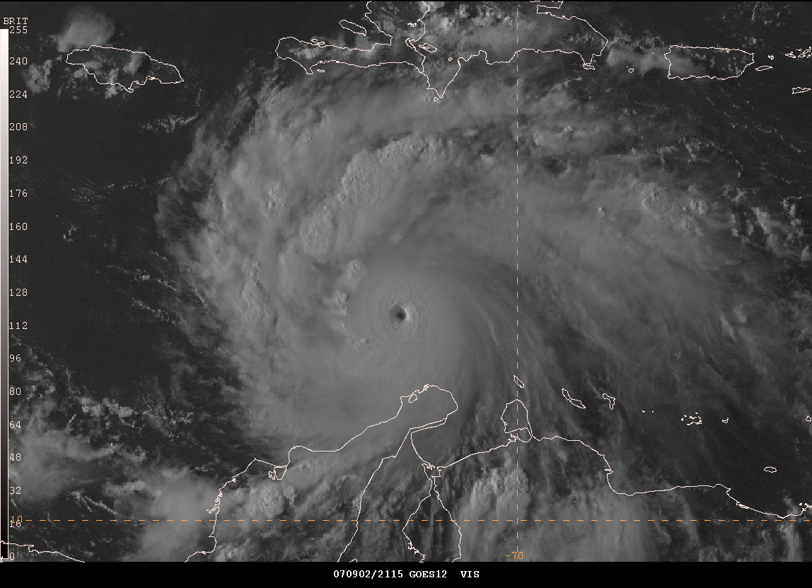
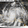
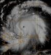
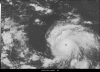
First light - visible
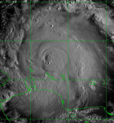
Hurricane Felix At First Light
    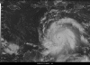
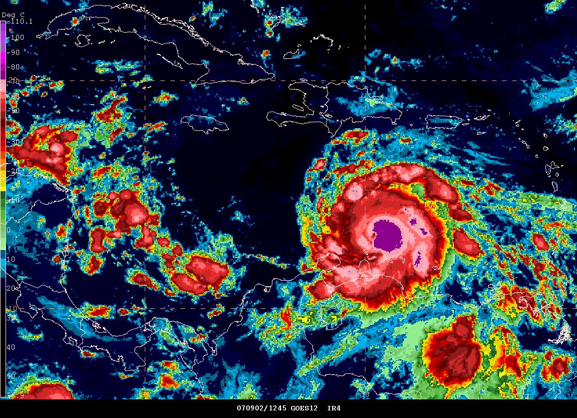
9 a.m Central Time - Hurricane Felix Gempak Images
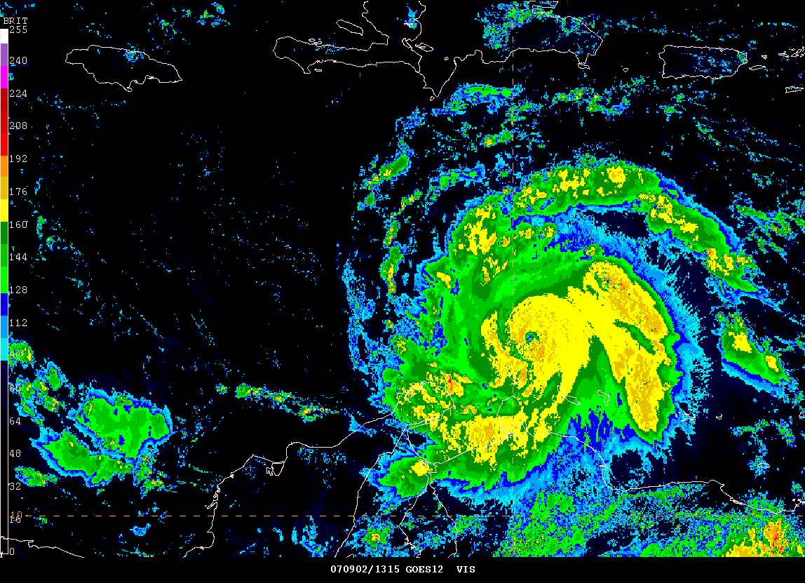
Hurricane Felix
Felix looks healthy this morning and now has winds of 100 mph with
gusts to 130 mph. This makes Hurricane Felix a category 2 on the
Saffir-Simpson Scale. Felix is becoming a dangerous hurricane and
will likely become a category 3 later today. It is not out of the
question that Felix could strengthen to a category 5 hurricane.
Felix may also interact with land much earlier than forecast as it
appears to be heading more south of west. Honduras could be
threatened as early as Monday Night and Tuesday. Stay tuned...
Radar Images...
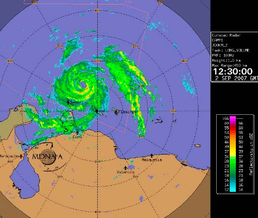
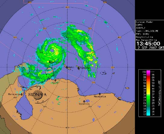

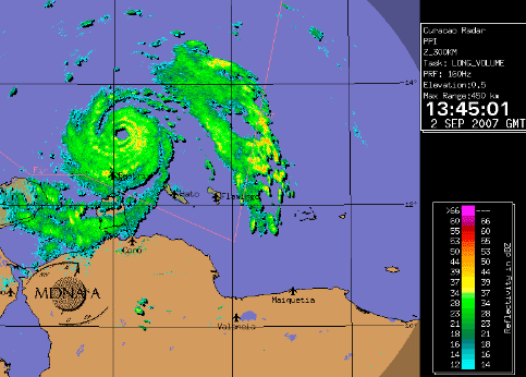
Weather
Radar Link
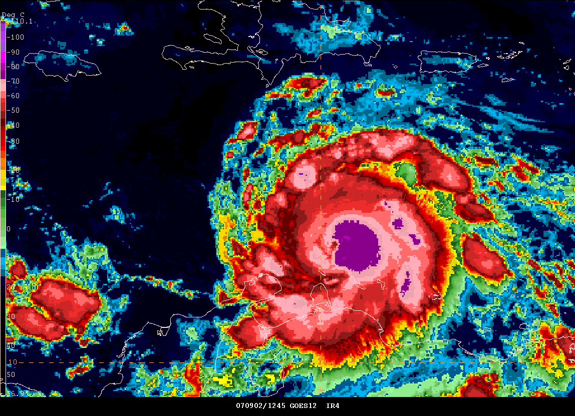
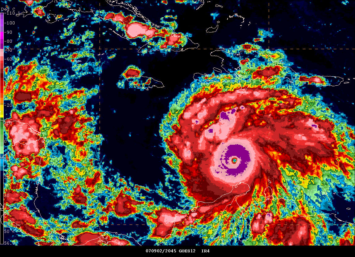
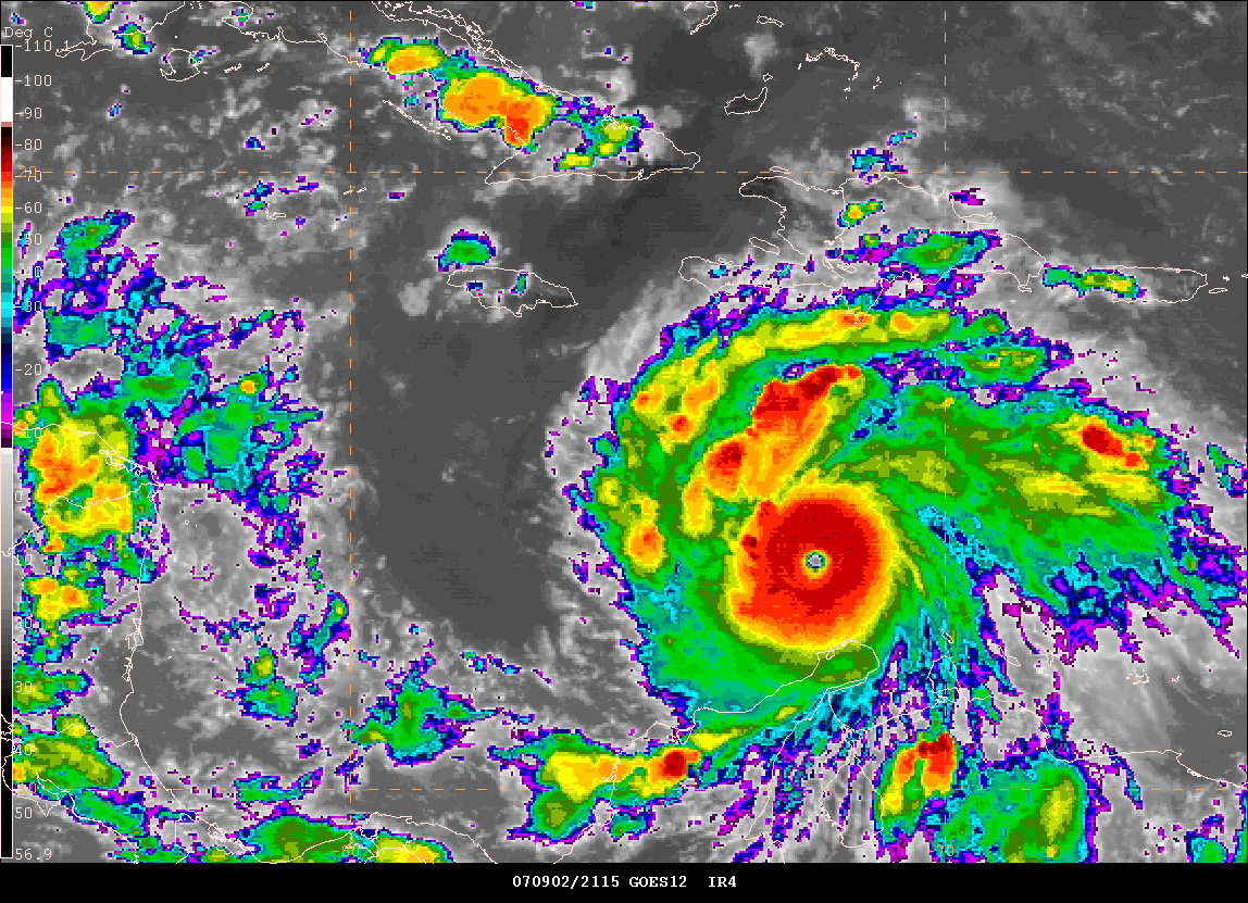
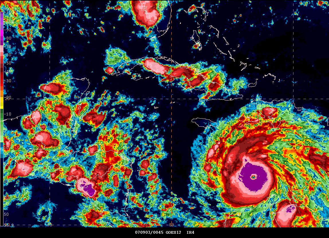
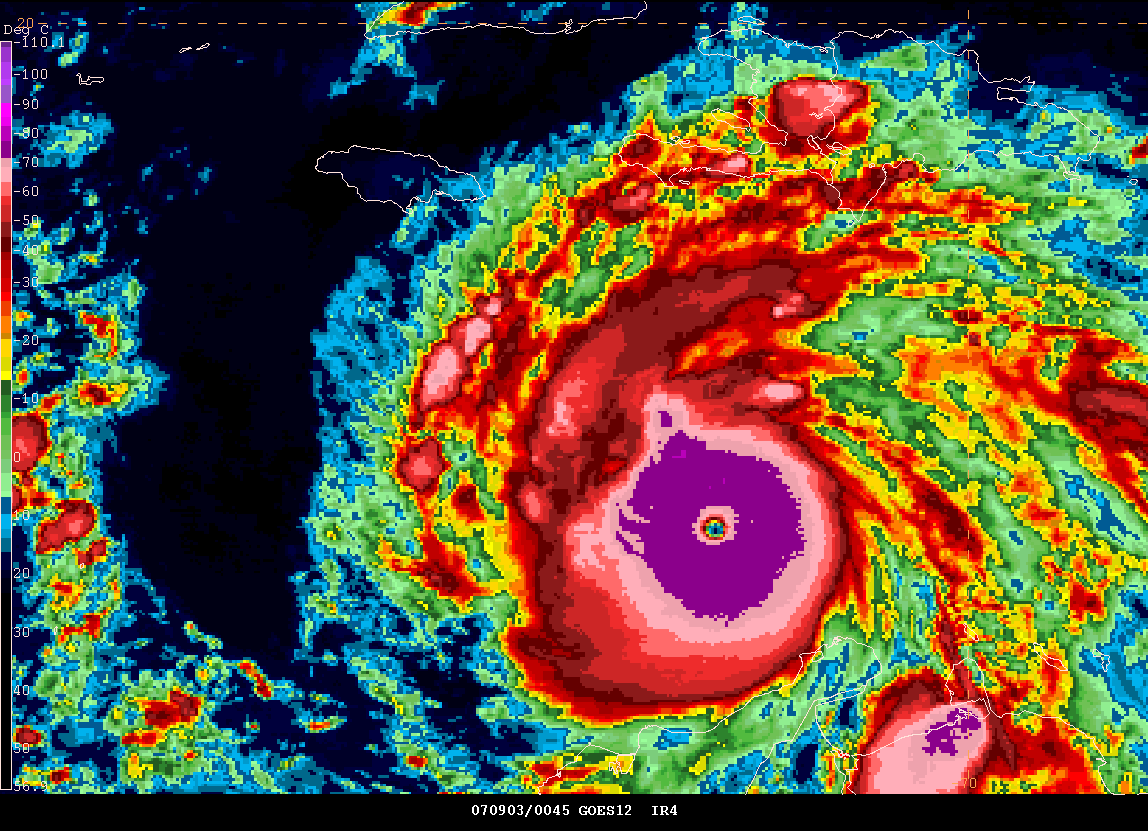
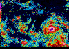
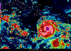
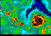
HURRICANE FELIX RAPIDLY STRENGTHENING IN THE CARIBBEAN...
CATEGORY FOUR AT 5 PM...
Category Four - Hurricane Felix
 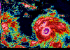   
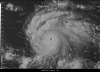  
5 PM Central Daylight Time - Gempak
Monster
Evening
Forecast
© 2006, PC Weather Products - Image From HurrTrak
Advanced 2006
____________________________________________________________
WHAT IS THIS??? The most rain we have had in 45 DAYS!!!
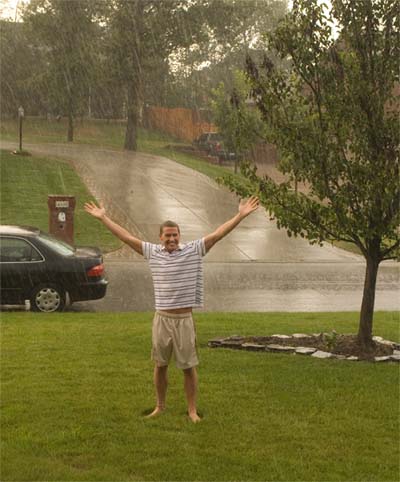
My first significant rainfall in 45 DAYS!!!! 0.29" fell in 20
minutes!
____________________________________________________________
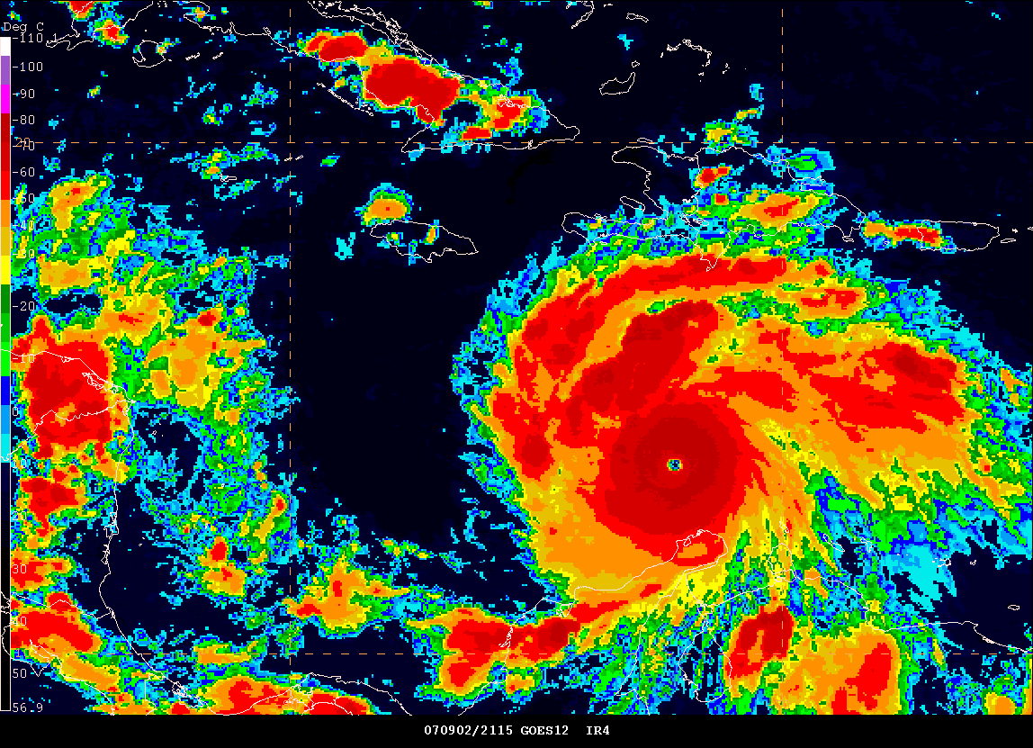
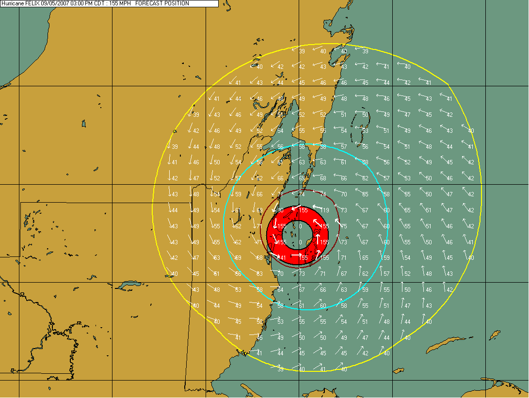
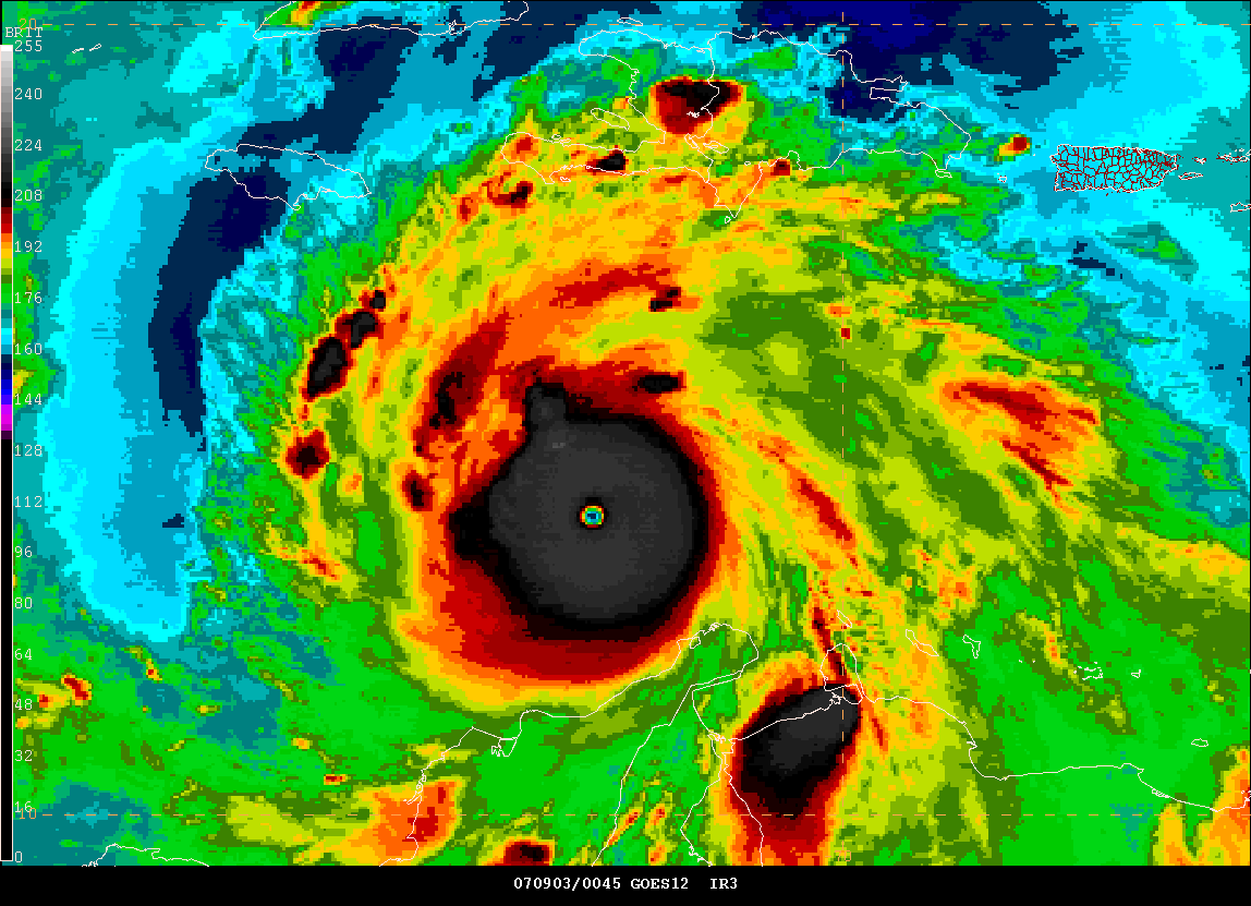
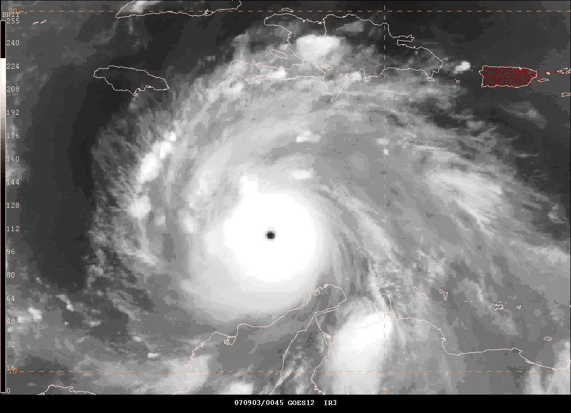
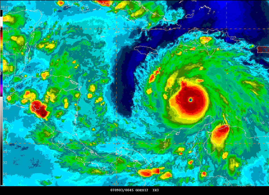
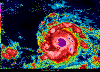
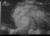
HURRICANE FELIX UPGRADED TO CATEGORY FIVE...
FELIX IS A MONSTER HURRICANE...WINDS GUSTING TO NEAR 200 MPH
HURRICANE FELIX SPECIAL ADVISORY NUMBER 10
NWS TPC/NATIONAL HURRICANE CENTER MIAMI FL AL062007
800 PM EDT SUN SEP 02 2007
...FELIX NOW A CATEGORY FIVE HURRICANE...
REPORTS FROM A NOAA HURRICANE HUNTER AIRCRAFT INDICATE THAT FELIX
CONTINUES TO RAPIDLY STRENGTHEN.
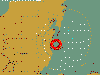
AT 800 PM EDT...0000Z...THE CENTER OF HURRICANE FELIX WAS LOCATED
NEAR LATITUDE 13.8 NORTH...LONGITUDE 72.9 WEST OR ABOUT 390 MILES...
625 KM...SOUTHEAST OF KINGSTON JAMAICA.
FELIX IS MOVING TOWARD THE WEST-NORTHWEST NEAR 18 MPH...30 KM/HR...
AND THIS GENERAL MOTION IS EXPECTED TO CONTINUE FOR THE NEXT 24
HOURS.
MAXIMUM SUSTAINED WINDS ARE NEAR 165 MPH...270 KM/HR...WITH HIGHER
GUSTS. FELIX IS A CATEGORY FIVE HURRICANE ON THE SAFFIR-SIMPSON
SCALE.
THE LATEST MINIMUM CENTRAL PRESSURE ESTIMATED FROM RECONNAISSANCE
DATA IS 934 MB...27.58 INCHES.
Evening Images from Gempak
HURRICANE FELIX ADVISORY NUMBER 11
NWS TPC/NATIONAL HURRICANE CENTER MIAMI FL AL062007
1100 PM EDT SUN SEP 02 2007
...HURRICANE WATCH ISSUED FOR HONDURAS AS POTENTIALLY CATASTROPHIC
HURRICANE FELIX MOVES WESTWARD IN THE CENTRAL CARIBBEAN...
____________________________________________________________
The Severe Drought Continues...
Severe Drought Continues For Our Region...
Turn the page for more
weather
|