August 21, 2007
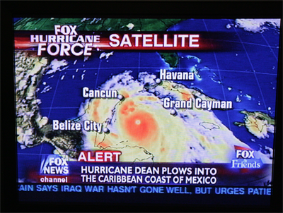
CATEGORY FIVE DEAN SLAMS INTO MEXICO
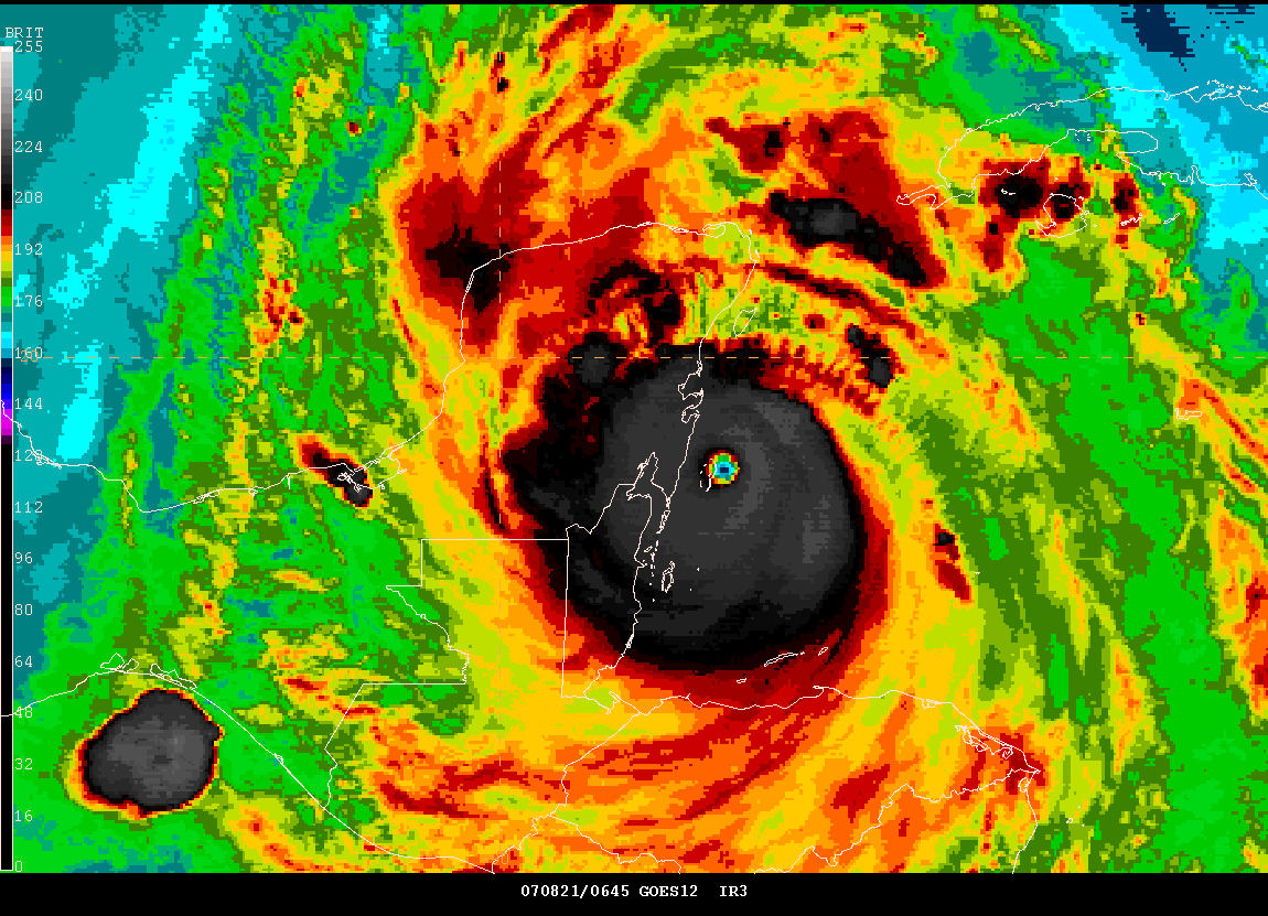
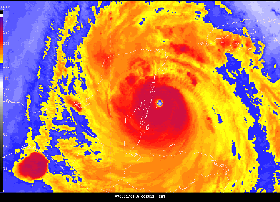
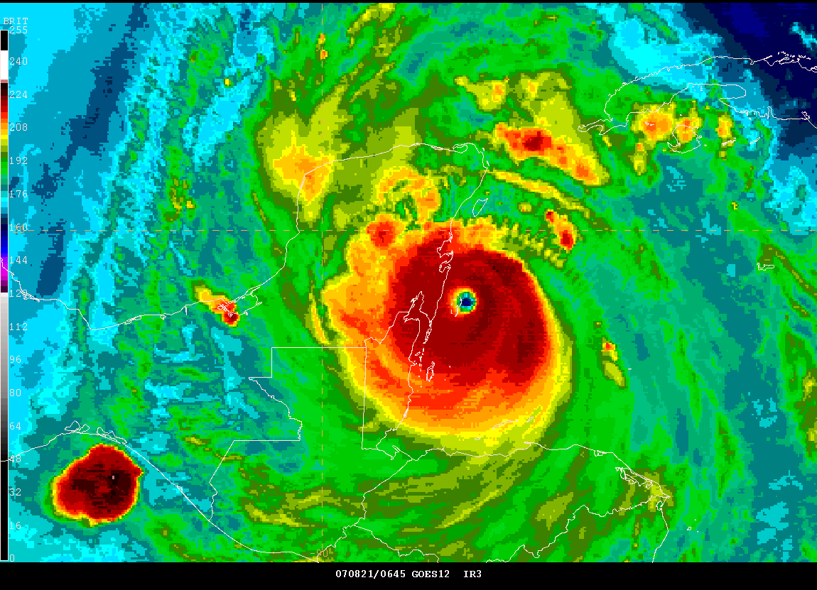
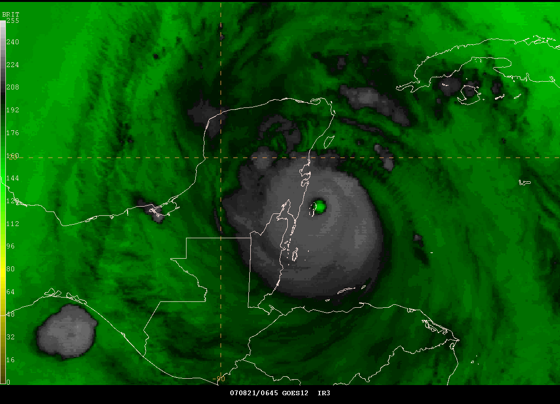
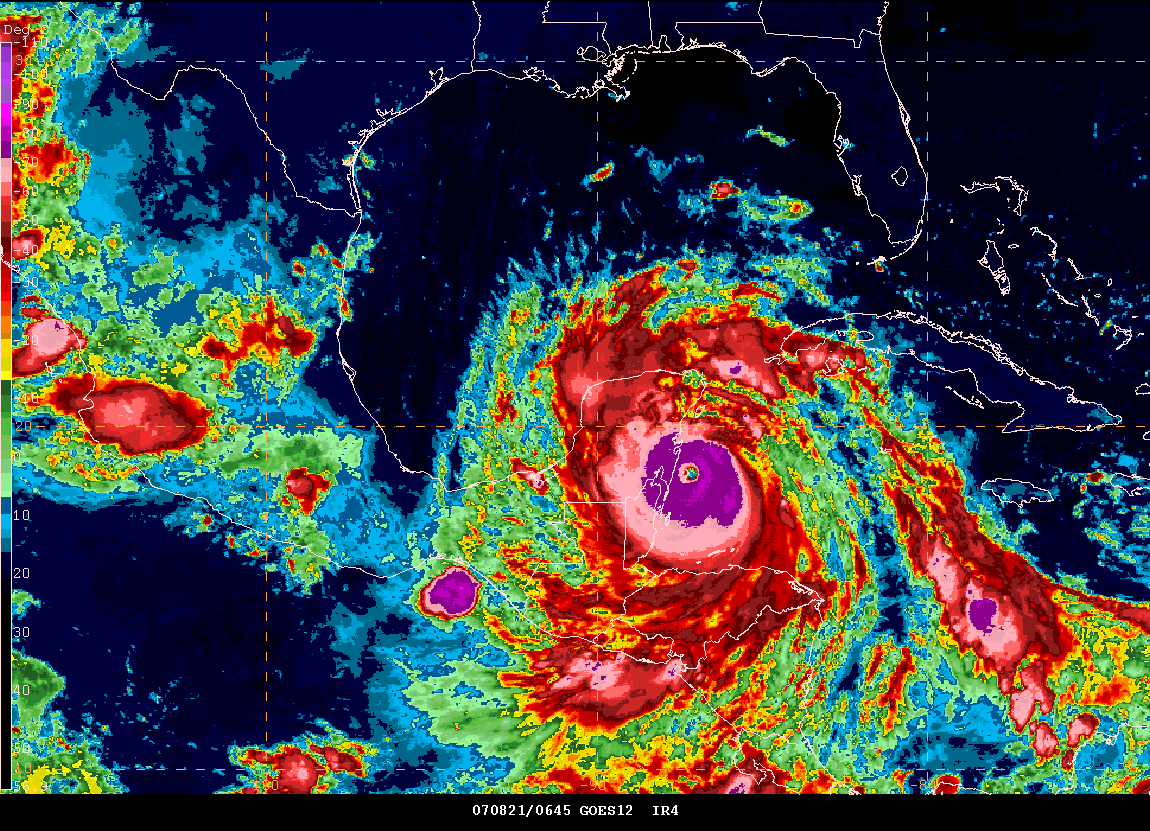
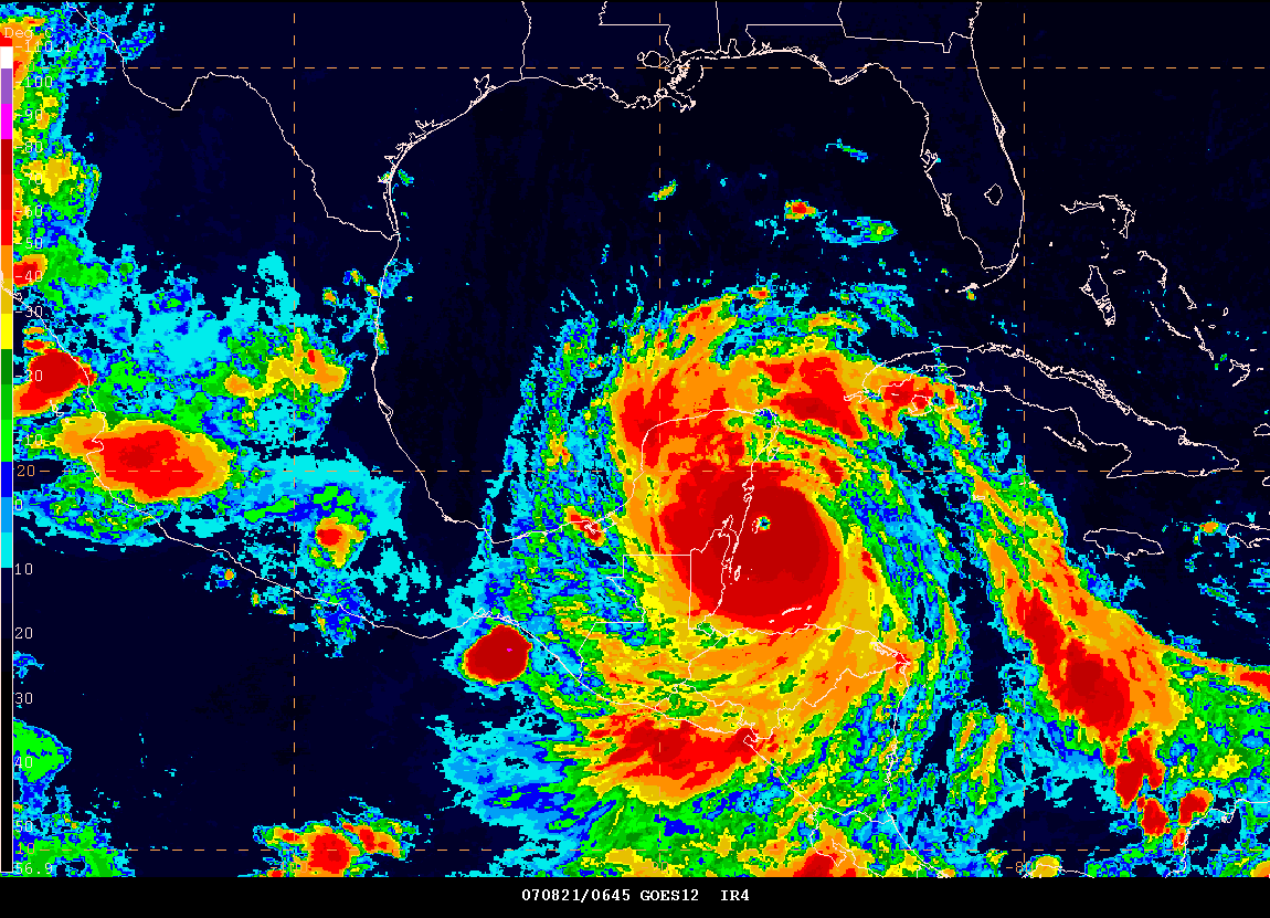
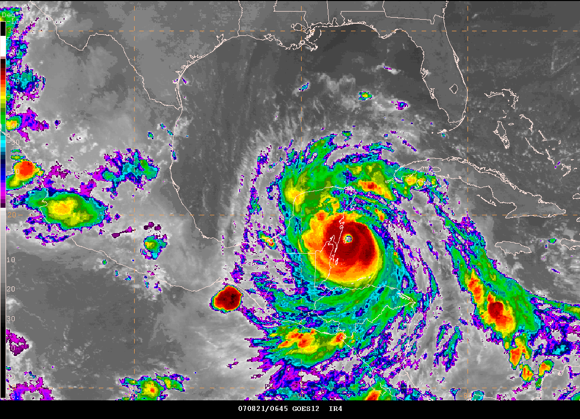
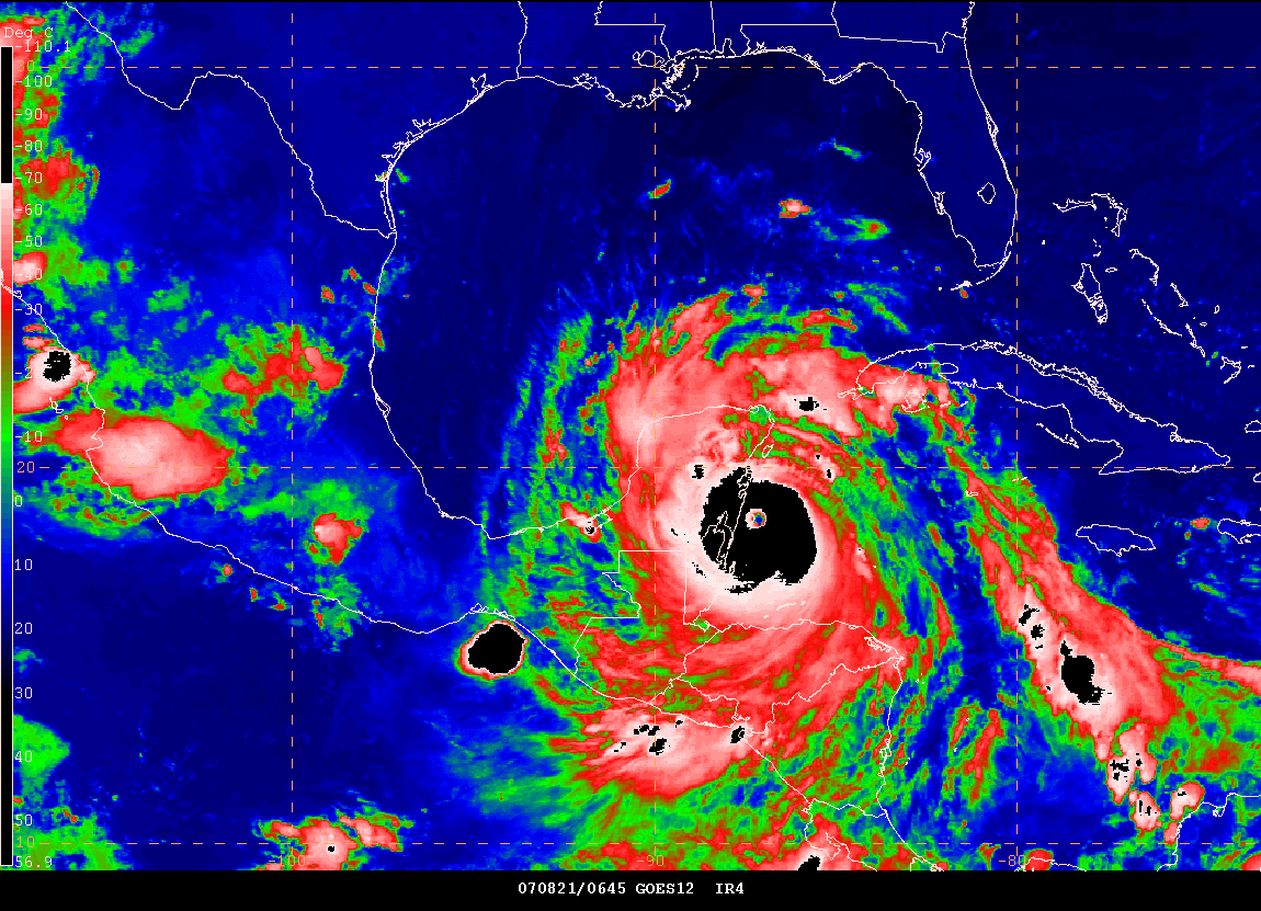
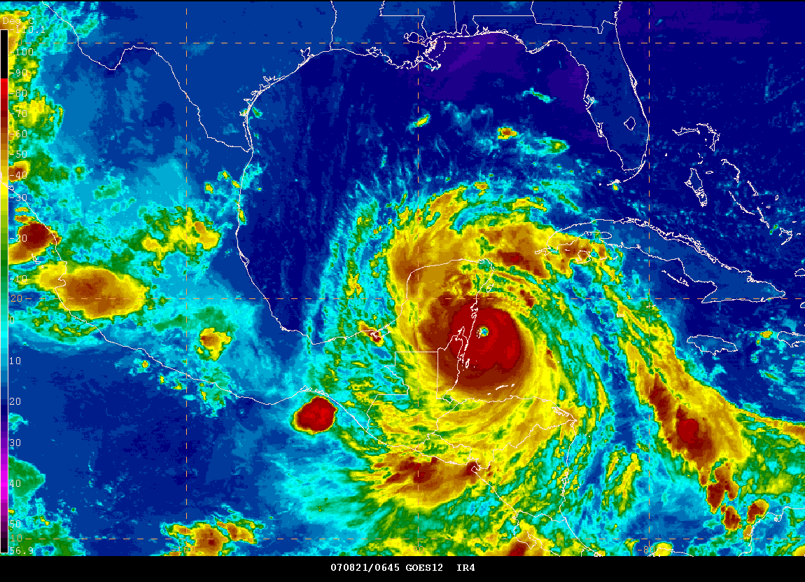
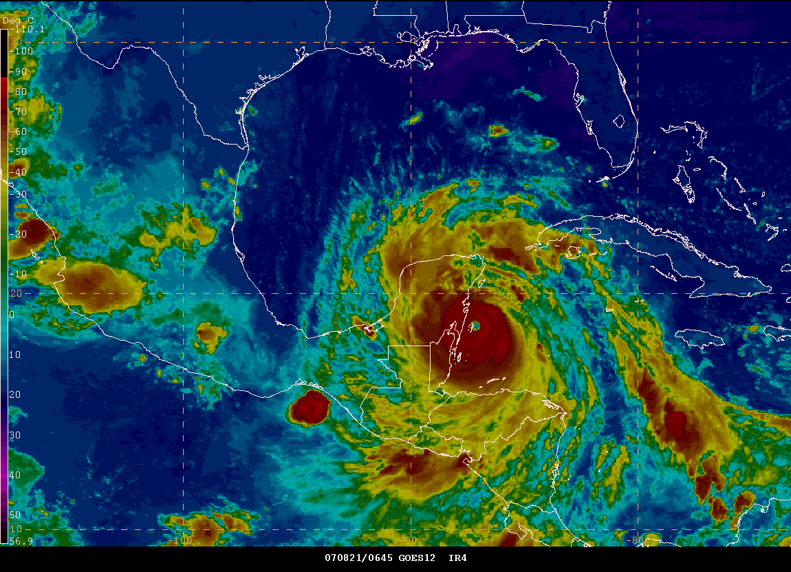
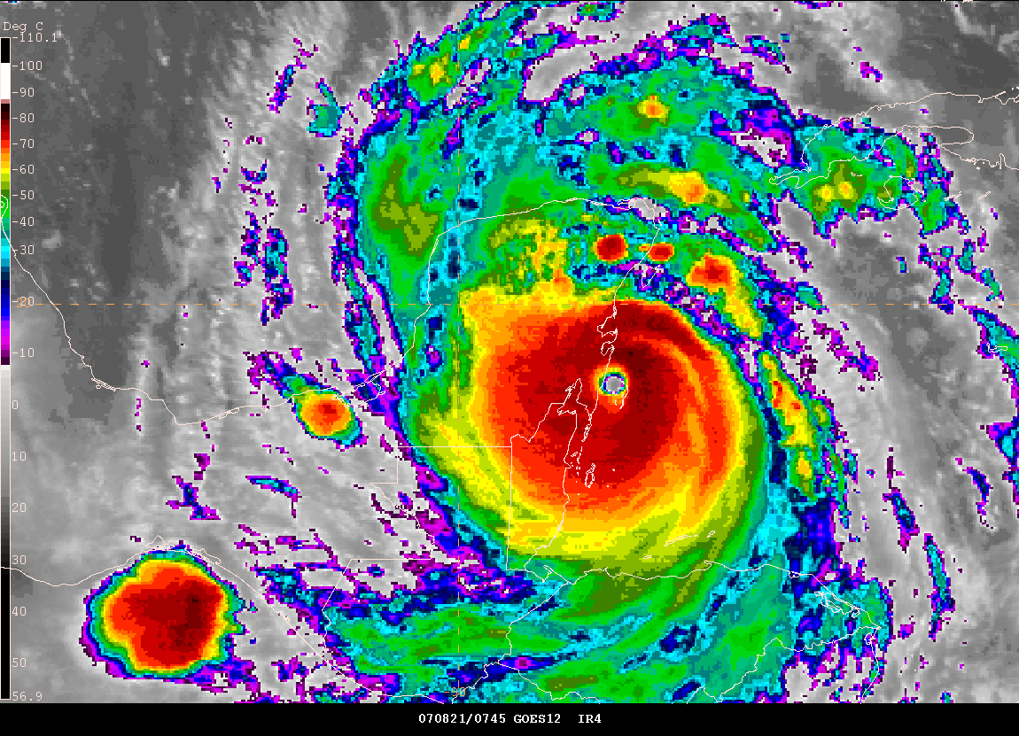
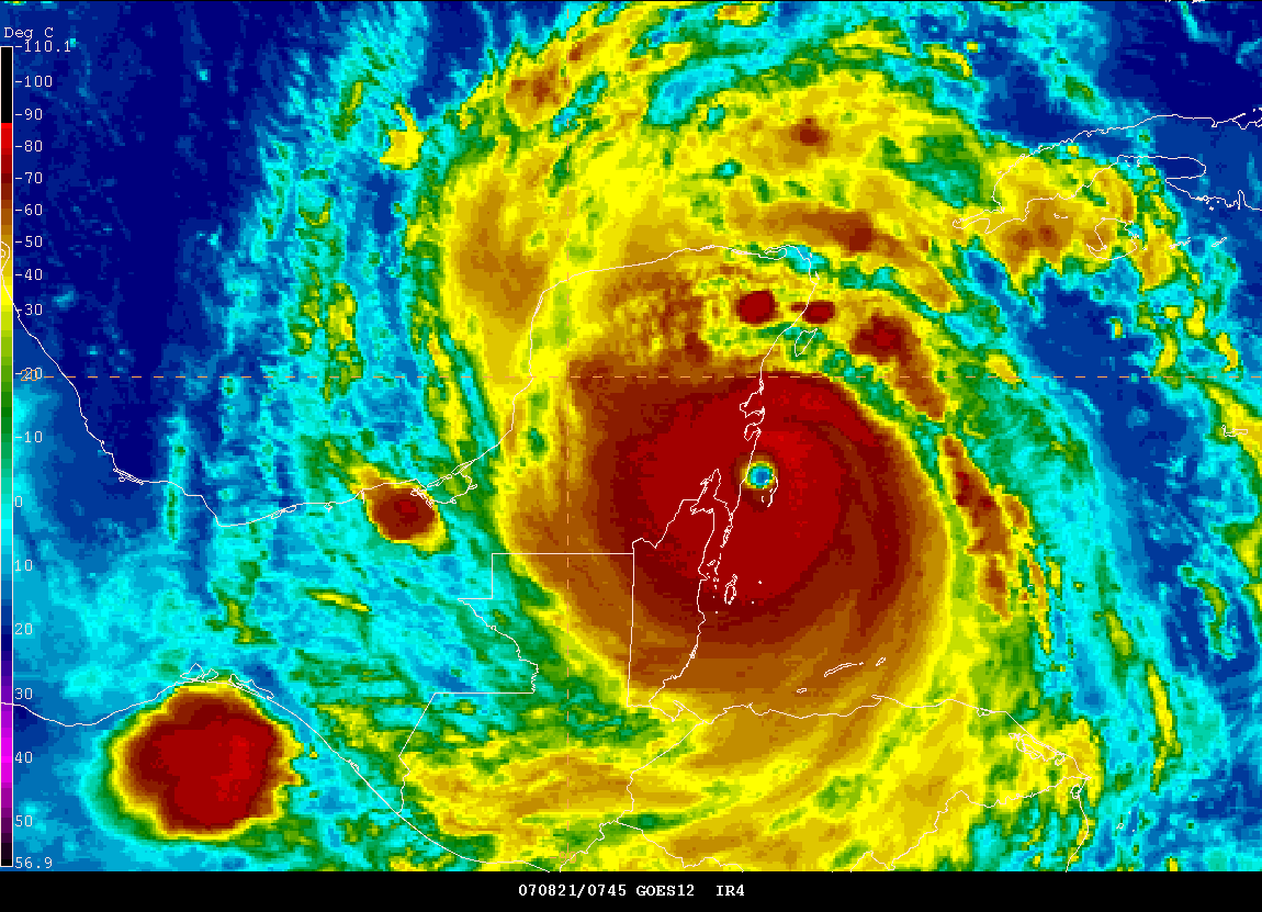
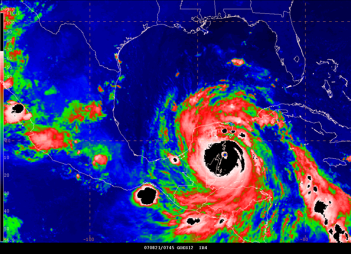
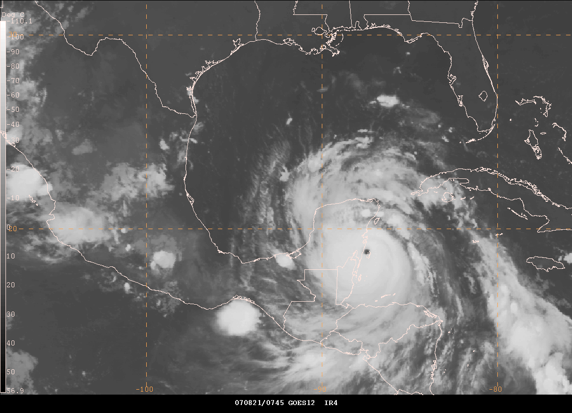
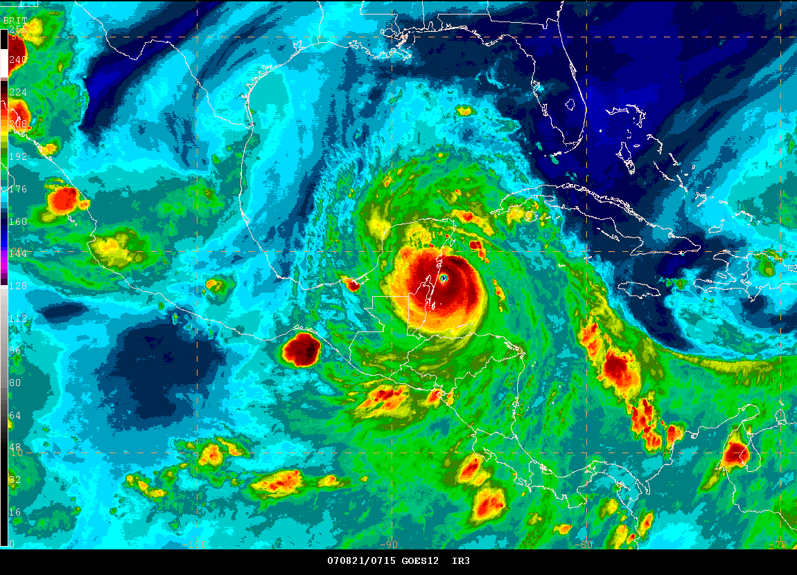
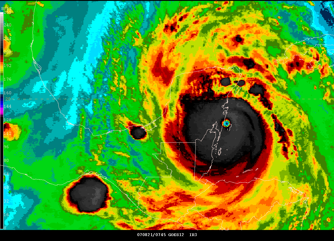
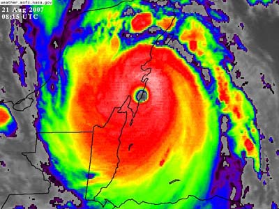
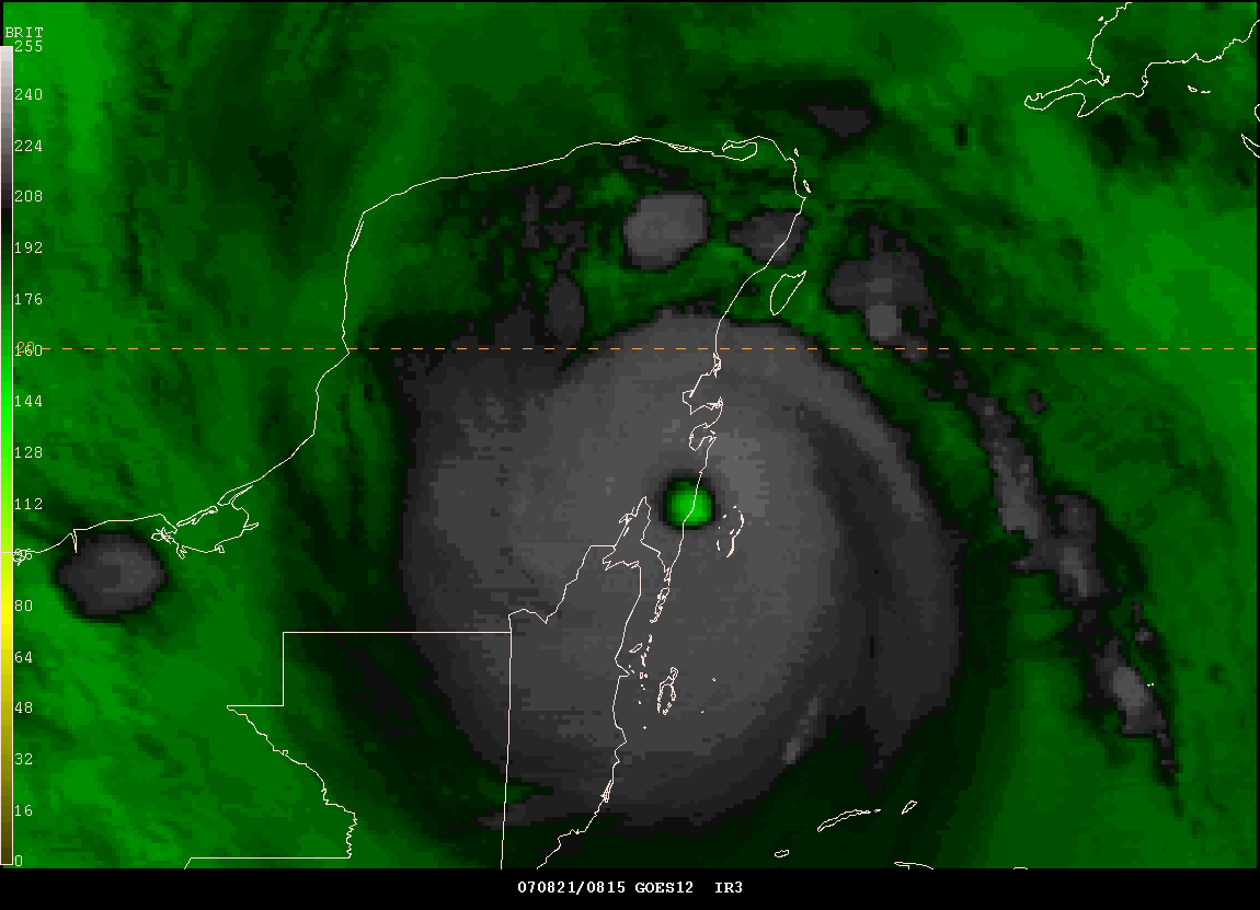
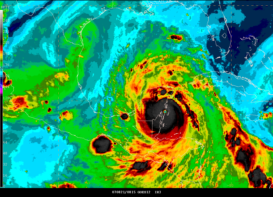
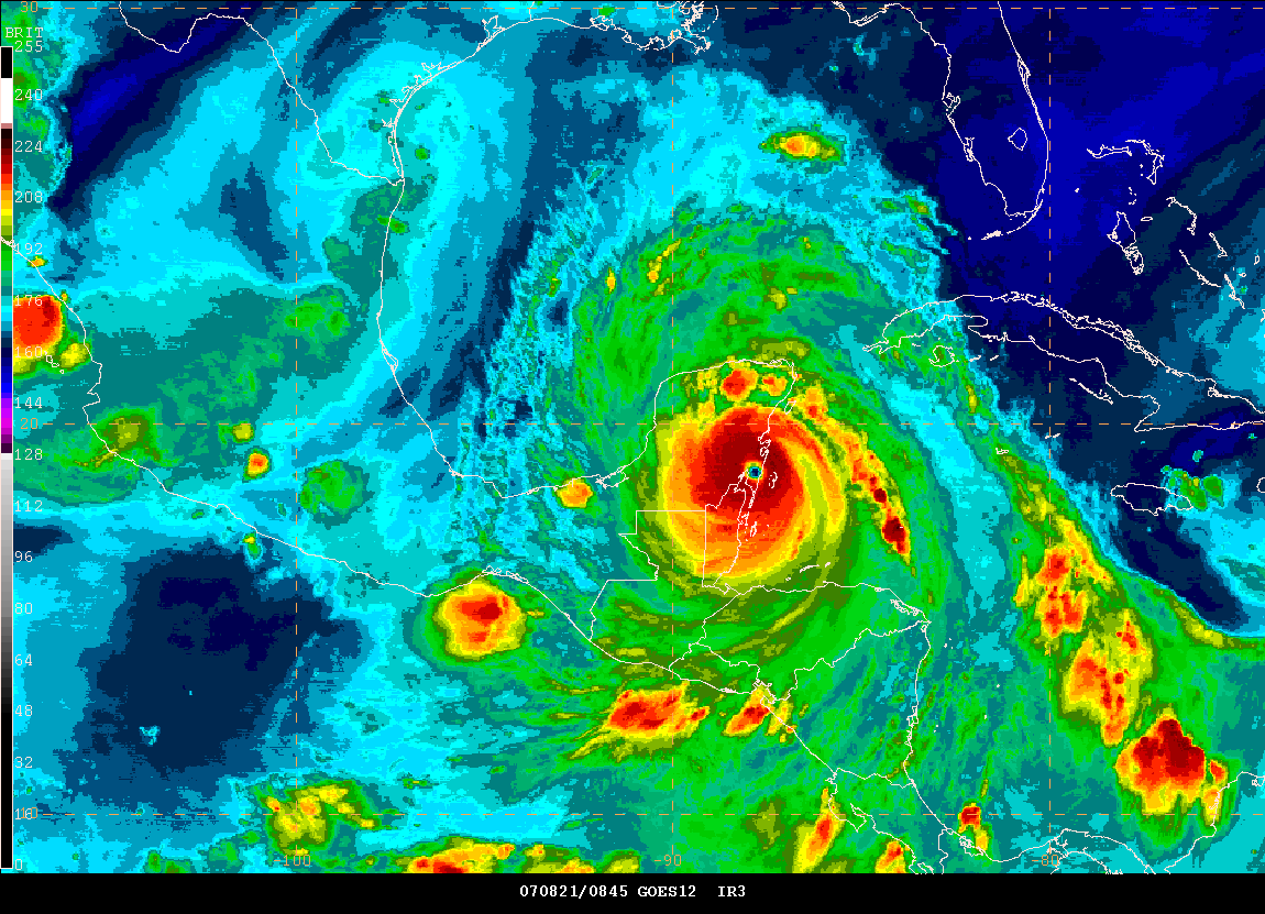
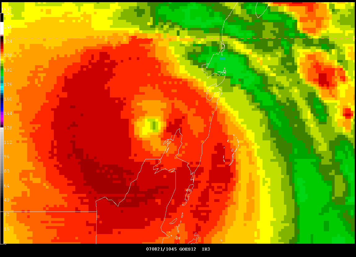
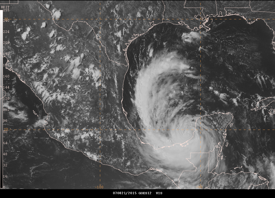
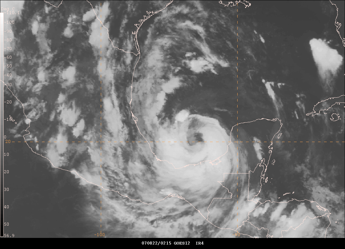
12:23 AM CDT - Eyewall of Hurricane Dean
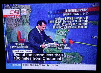
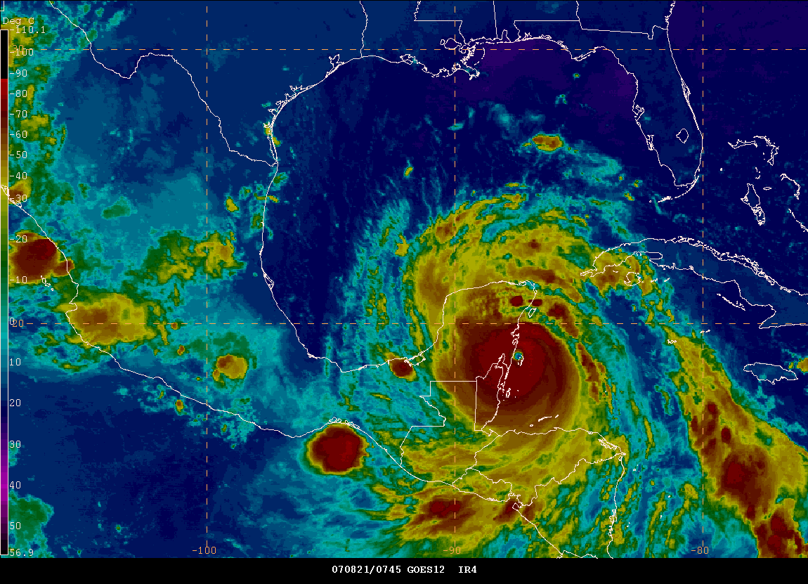
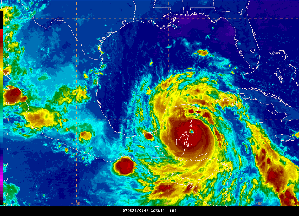
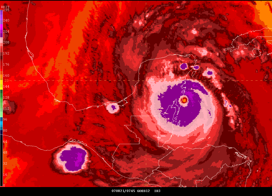
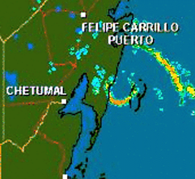
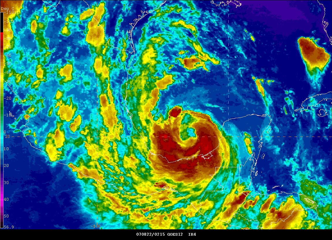
Catastrophic Hurricane Dean slammed into Mexico this morning with winds over 160 miles per hour. The National Hurricane Center estimated winds were gusting to 195 miles per hour. Several communities were in the path of the eye. The fate of those towns will be unknown for several days perhaps. One hurricane chaser, Josh Morgerman, is riding out the storm in the town of Chetumal. His posts can be read on this thread.
2 AM EDT - National Hurricane Center Statement
BULLETIN
HURRICANE DEAN INTERMEDIATE ADVISORY NUMBER 32A
NWS TPC/NATIONAL HURRICANE CENTER MIAMI FL AL042007
200 AM EDT TUE AUG 21 2007
...POTENTIALLY CATASTROPHIC HURRICANE DEAN BEARING DOWN ON THE EAST
COAST OF THE YUCATAN PENINSULA...
AT 200 AM EDT...0600Z...THE EYE OF HURRICANE DEAN WAS LOCATED
BY AN
AIR FORCE HURRICANE HUNTER PLANE NEAR LATITUDE 18.5 NORTH...
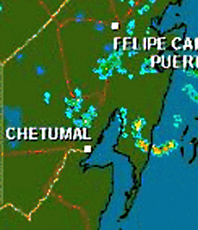
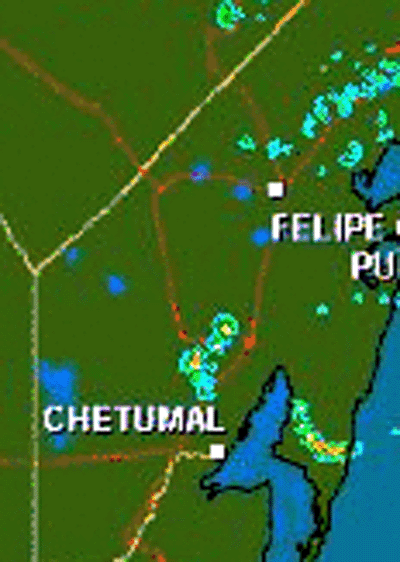
LONGITUDE 86.8 WEST OR ABOUT 100 MILES...160 KM...EAST OF CHETUMAL
MEXICO AND ABOUT 260 MILES...420 KM...EAST-SOUTHEAST OF CAMPECHE
MEXICO.
MAXIMUM SUSTAINED WINDS ARE NEAR 160 MPH...260 KM/HR...WITH HIGHER
GUSTS. DEAN IS A POTENTIALLY CATASTROPHIC CATEGORY FIVE HURRICANE
ON THE SAFFIR-SIMPSON HURRICANE SCALE. LITTLE CHANGE IN STRENGTH
IS EXPECTED PRIOR TO LANDFALL. ALTHOUGH SOME WEAKENING IS FORECAST
AS DEAN CROSSES THE YUCATAN PENINSULA...DEAN IS EXPECTED TO
MAINTAIN HURRICANE STRENGTH THROUGHOUT THE NEXT 24 HOURS.
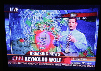
CNN at 1 AM - August 21, 2007
Coming Ashore - 2:15 AM CDT


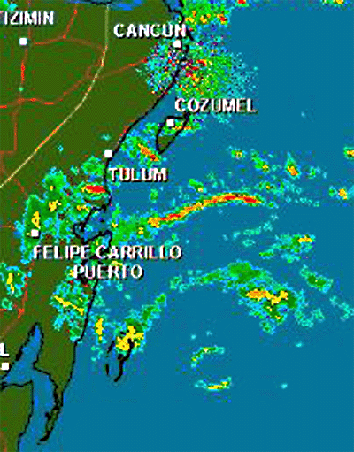
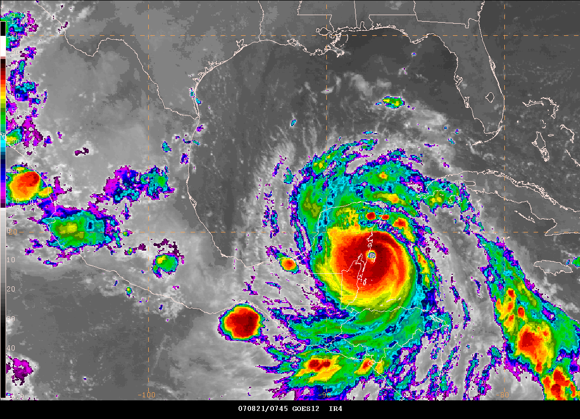
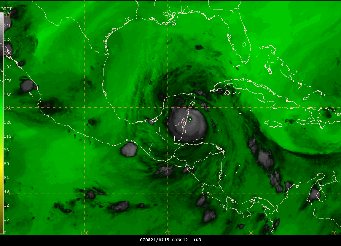
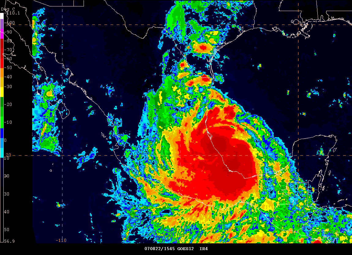
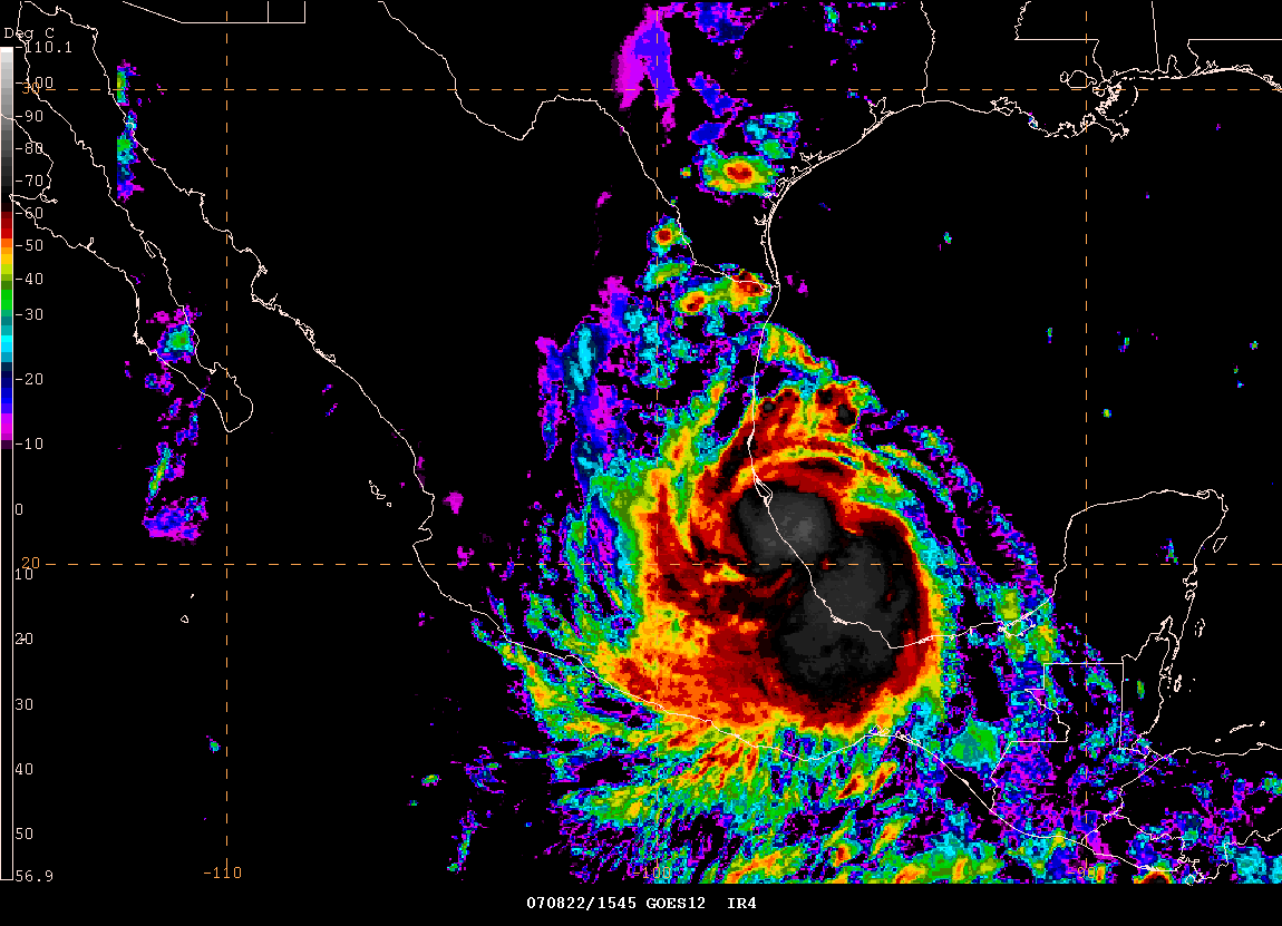
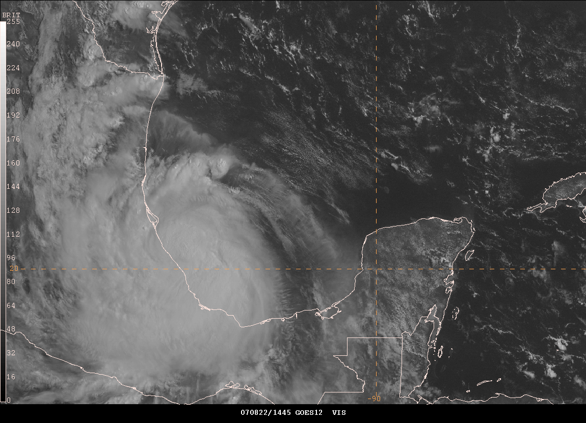
2 AM CDT - Images
2 AM CDT - Radar Animation (they keep zooming in and out)
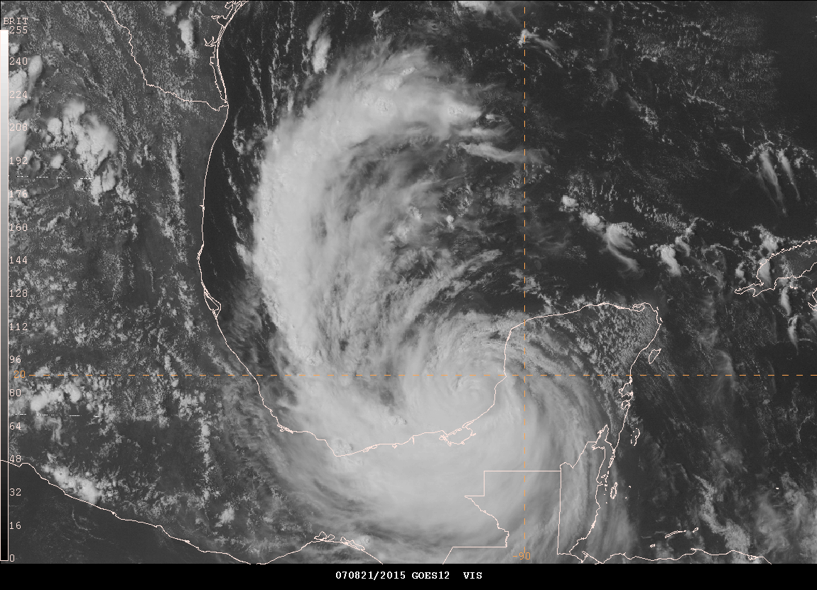
2:50 AM CDT - MOVING ASHORE
Josh is reporting extremely high winds now at his hotel. He has lost power and a friend is posting for him on the chase blog. He is hearing a loud roar in the air. The eye is just east of him.


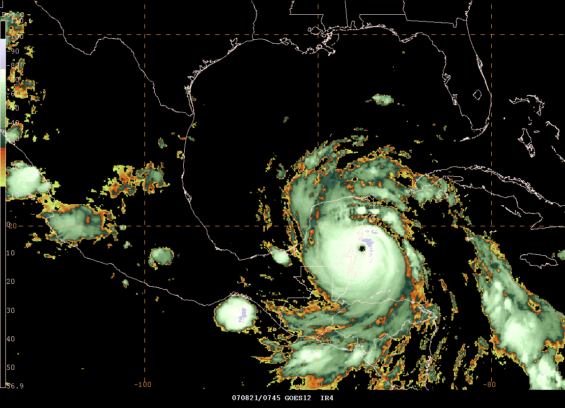
3 AM CDT Images
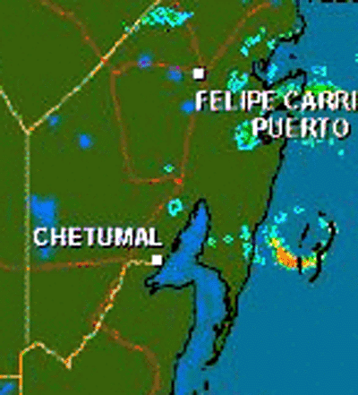
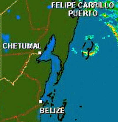
3:10 AM CDT Cancun Radar
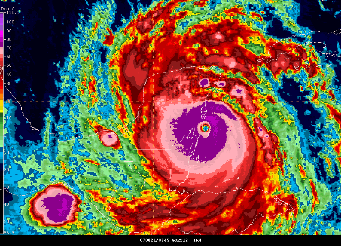
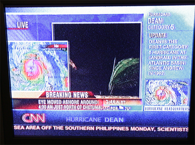
Landfall of Hurricane Dean - 3:15 AM CDT
3:15 AM CDT Radar - Eye Moving Ashore
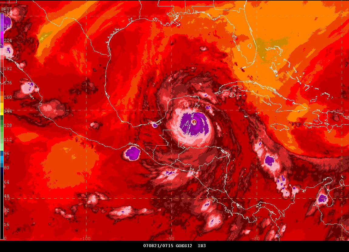
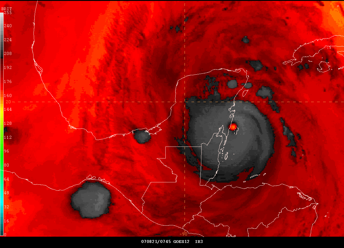
RECON REPORT
967
URNT12 KNHC 210833
VORTEX DATA MESSAGE AL042007
A. 21/08:14:00Z
B. 18 deg 41 min N
087 deg 34 min W
C. 700 mb 2286 m
D. 114 kt
E. 140 deg 9 nm
F. 239 deg 116 kt
G. 139 deg 008 nm
H. 906 mb
I. 11 C/ 3053 m
J. 23 C/ 3044 m
K. 12 C/ NA
L. CLOSED WALL
M. C15
N. 12345/7
O. 0.02 / 2 nm
P. AF306 1504A DEAN OB 25
MAX FL WIND 164 KT N QUAD 08:18:40Z
CONTINUOUS LIGHTING AND SEVERE TURBULENCE SOUTH EYEWALL
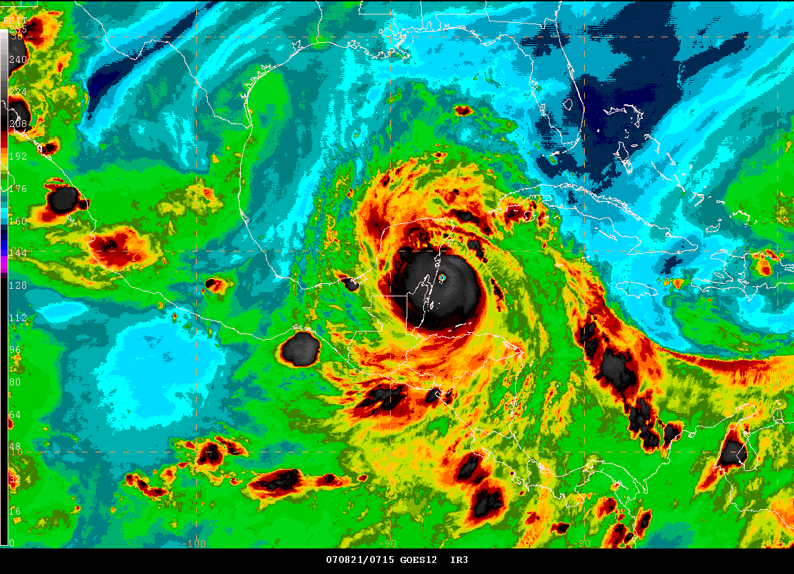
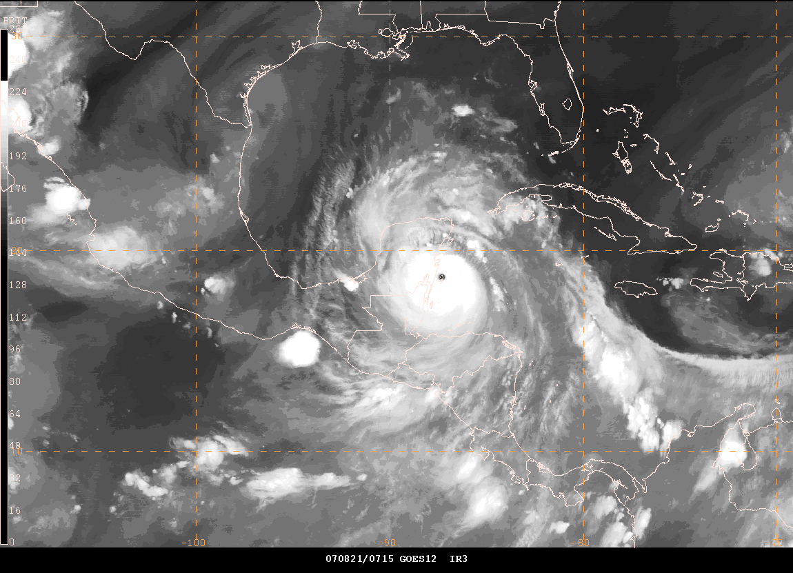
Dean Reaches Shore...

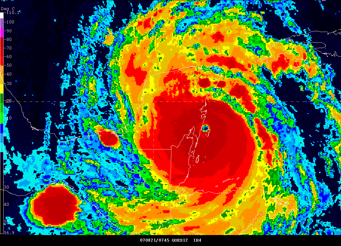
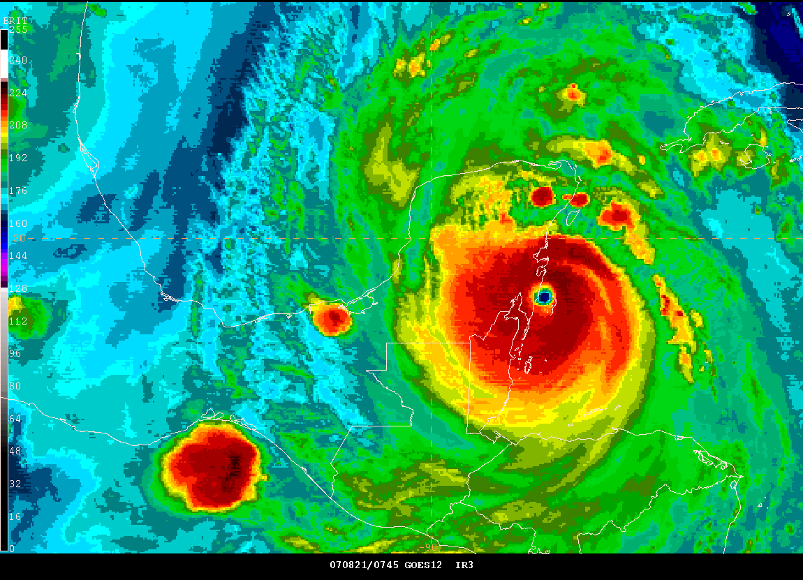
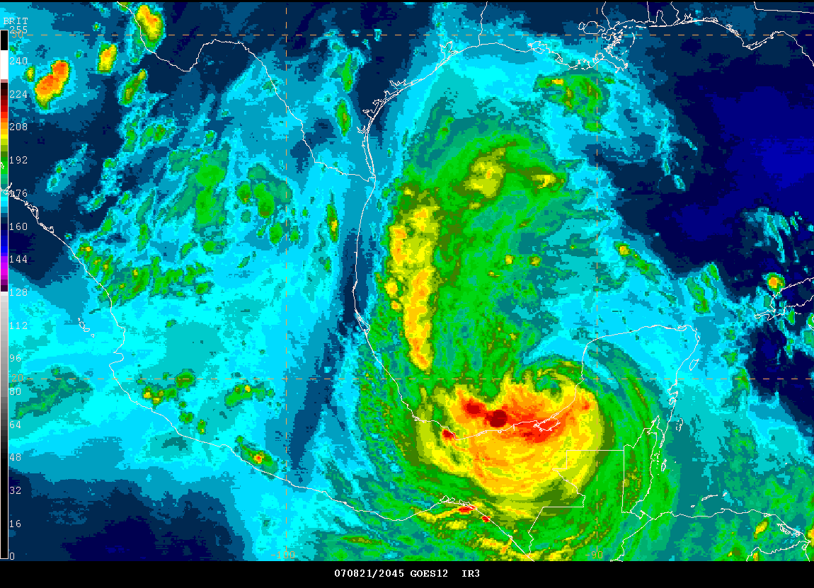
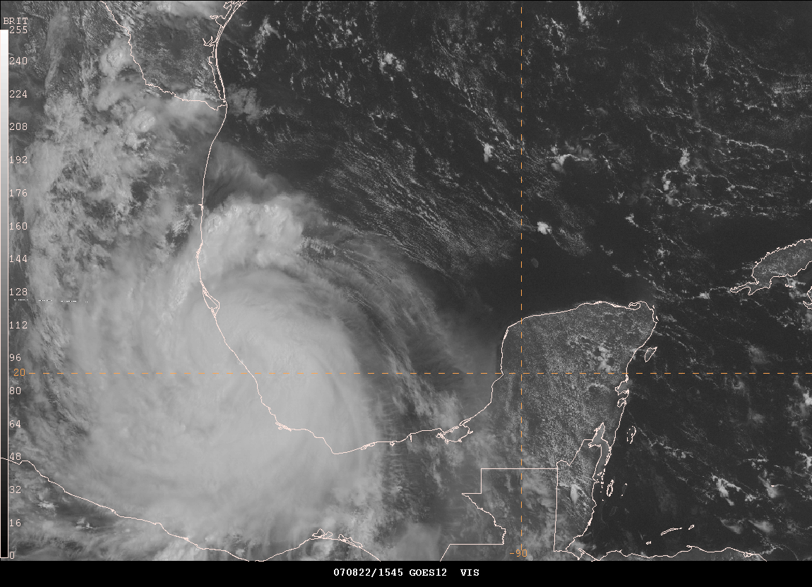
3:45 AM CDT Images
Very tired at this hour. It is 3:45 AM and we are watching history. The lowest pressure reading was 906mb. This makes Hurricane Dean the 8th strongest hurricane in the Atlantic Basin - pressure wise. We have not heard from Josh (icyclone) for awhile now. Hopefully he is doing okay. His friend talked to him about 20-30 minutes ago. Conditions were rapidly deteriorating at that time.
3:50 AM CDT Cancun Radar
Josh Morgerman just reported from Chetumal, Mexico VIA his friend Keith:
Wind very violent, first window smashed... glass came raining down.. awful sounds outside... howling, whistling, and banging. In dark with candles... retreating into interior of building... other people seem calm. Hope to continue posting, but this may be the last for now.
____________________________________________________________
Also Ham Radio Operators are reporting winds of over 100 mph near the center with palm trees folding and bending. Abby Toltin reported that information from near Playa Del Carmen. Estimated numbers. 3:45 AM CDT
____________________________________________________________
3:50 am CDT (this is the last report from
Josh Morgerman)
Wind very violent, first window smashed... glass came raining down..
awful sounds outside... howling, whistling, and banging. In dark with
candles... retreating into interior of building... other people seem
calm. Hope to continue posting, but this may be the last for now.
Dictated by Josh via telephone; posted by his friend Keith
____________________________________________________________
The National Hurricane Center now reports winds are sustained at 165 MPH with gusts to near 200 MPH. Pressure is down to 906mb. This is an extremely dangerous hurricane. 4 AM CDT.
4 AM Breaking News
4 AM Breaking News
4:09 AM CDT - Ham Radio Operator reports 100 mph sustained winds near Cozumel. Palm trees bent over.
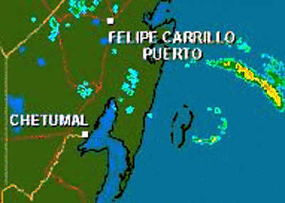
4 AM CDT Radar
4:18 AM CDT - The eyewall is approaching Chetumal at this time. Winds will likely be over 140 MPH in that city with gusts to 180 MPH. Extreme or catastrophic damage is expected in these areas. The storm surge will be to the north of this region. This will keep the worst damage to the north/northeast of Chetumal.
____________________________________________________________
4:30 AM CDT - Report from Puerto Aventuras, Mexico - water has come up 10
feet in just a few minutes.
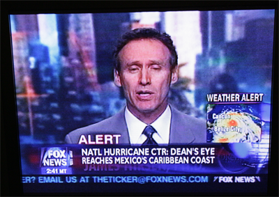
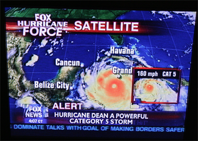
4:35 AM FOX News Bulletin...
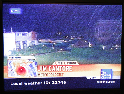
4:40 AM - Jim Cantore reports in from his location
4:45 AM - Eye makes landfall near Josh in Chetumal
4:34 an CDT - Josh
Morgerman is reporting in VIA his friend
Keith
I am on 4th floor... windows all boarded up , but loud whistling sound
coming through. Ceiling light fixtures bobbing up and down. I think roof
may have opened up or some may have come off. Loud crashing sounds
indicate things hitting building. When I peek out intact windows, most
trees in front of hotel are down. We are getting through it and most
people are calm.
KEITH'S NOTES.... I told Josh that radar indicated eyewall of storm was
passing just north of him, and he agreed that while this was the worst
conditions he had ever experienced, they were not Cat 5.
Dictated by Josh via telephone; posted by his friend Keith
____________________________________________________________
4:50 AM CDT - Reports from Chetumal are saying that all power is
out. Reports of extensive damage coming in from along the
coastline of Mexico from Cancun all the way south to below Chetumal.
4:51 AM - Fox News Hurricane Dean has 165 MPH Winds.
5:00 AM CDT
5:00 AM CDT - CNN reports that the Mexican Government sent 4000 troops to the area where the eye has moved ashore.
____________________________________________________________
5 am CDT - Josh
Morgerman Report
Wind continues... very violent, rapidly shifting direction - but
it hasn't increased in a while - and I have a feeling it won't get
worse. Streets are flooded - not sure if it's rain or maybe storm surge.
Sounds are creepy and weird... special effects sounds. Not sure where we
are going from here...
Dictated by Josh via telephone; posted by his friend Keith
____________________________________________________________
5:06 AM CDT - Ham Radio Operators are reporting very high winds near Cozumel Island. Palm leaves are still on the trees though at their location.
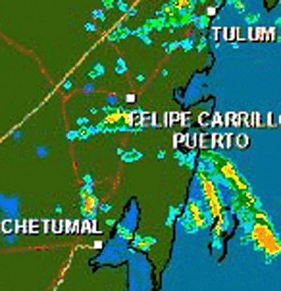
5:00 AM Radar Cancun
5:11 AM CDT - Fox News Reporters are saying that winds are over 50 miles
per hour in Cancun.
____________________________________________________________
5:20 am CDT - Josh
Morgerman reporting from Chetumal, Mexico
Spoke too soon... highest winds so far - lots of trees going down - much
heavier rain
Dictated by Josh via telephone; posted by his friend Keith
____________________________________________________________
5:21 AM CDT - Reports VIA CNN - Corozal, Belize - houses off of roofs - lot of debris flying around. Reports of major damage.
____________________________________________________________
5:29 AM CDT - The Weather Channel reports that some people in Puerto Avemturas believe it was more hype than anything. A man from New Orleans said he wasn't impressed.
____________________________________________________________
5:37 AM CDT - News media reports some damage in Cancun but nothing major from what they can see. Moderate to heavy rainfall is falling in the City of Cancun.
____________________________________________________________
5:40 AM CDT - Cancun shelters reported as quiet with people sleeping.
____________________________________________________________
5:42 AM CDT - Report from Ham Radio Operators to the NHC said winds of 80 miles per hour in Belize.
____________________________________________________________
5:45 AM CDT - Reports of roof damage or roofs off in Belize City.
____________________________________________________________
5:47 AM CDT - Corozal - South of Chetumal - roof damage reported to buildings.
____________________________________________________________
5:50 am CDT - Report from
Josh Morgerman
Winds probably blowing as hard or harder as they have all night. More
trees going down and loud banging from hotel across the street. However,
the adrenaline has worn off, and I am tired. It is hard to say, because
it is completely dark and we can't see much, but my impression is that
Chetumal has been hammered but not devastated. The city missed
catastrophe by the skin of its teeth. We got off easy. I don't know when
you guys will hear from me next, but know that I'm sure we're going to
come through this fine. Thanks to all for your help and support. Love
you guys
Dictated by Josh via telephone; posted by his friend Keith
____________________________________________________________
6:00 AM CDT - Kerry Sanders from NBC there too--reporting the wall of a church being used as a shelter has had a wall give way, 35 people in there, no way to get to them now
____________________________________________________________
6:05 AM CDT - CNN reports 1 1/2 Billion Dollars in damage to Jamaica.
____________________________________________________________
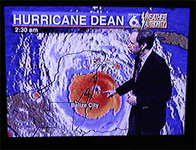
Cal Sisto - August 21, 2007 - Local NBC Meteorologist
6 AM CDT
6:15 AM CDT - All news media outlets are reporting on Hurricane Dean. Reporters are calling in live from different resort communities or are doing satellite uplinks. Reporters are saying that they can hear glass breaking in their building - Chetumal. Reports of loud noises. Winds picking up tremendously. Heavy rain also falling with streets flooded. Reports of roofs coming off of buildings in that city. Major tree damage with a lot of trees uprooted. You can hear pieces of signage coming off the building as the reports talks on the phone. Harris Whitbeck is the reporter on CNN at this time. He is reporting from the parking garage of his hotel.
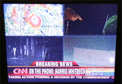
CNN reporting live from where Josh is located in Chetumal.
____________________________________________________________
6:27 AM CDT - Corozal - Reports of phone service out. 100 mph winds have been reported with roofs off of buildings and houses. Reports of major tree damage and power lines down. Foam and debris noted scattered through the streets.
6:30 AM CDT - going to bed!
____________________________________________________________
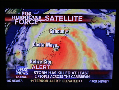
Noon - Reports of heavy damage are coming in from Mexico. It is still early to determine the extent of the damage. Major flooding is reported along the coastline. Thousands of homes and businesses have been damaged or destroyed. It will be a few days before we know just how extensive the damage was in the hardest hit areas - the eyewall. Reports indicated that winds should have gusted over 180 mph where the eye made landfall.
Photos from Reuters: Click Here
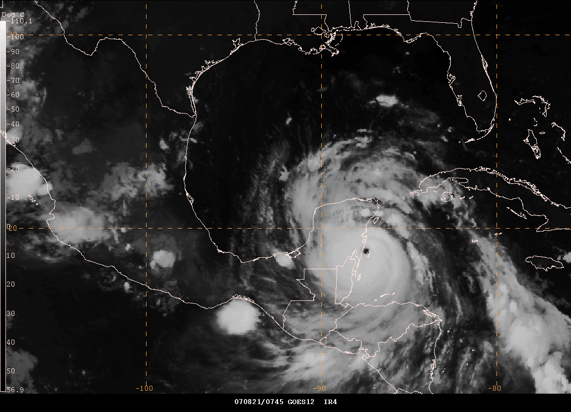
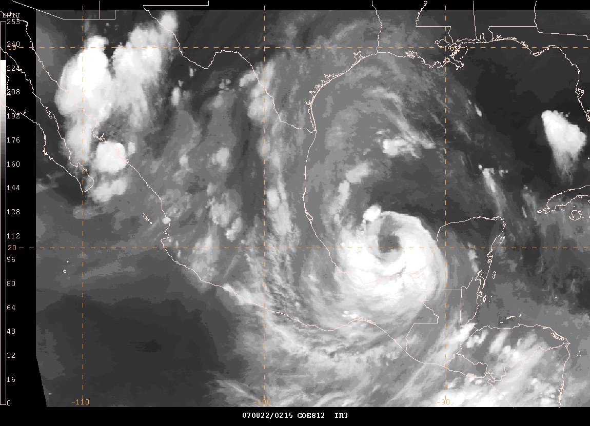
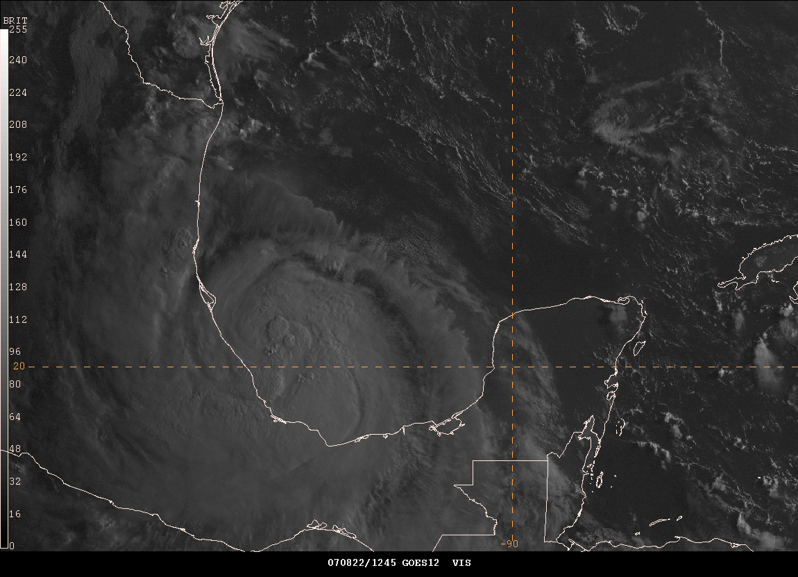
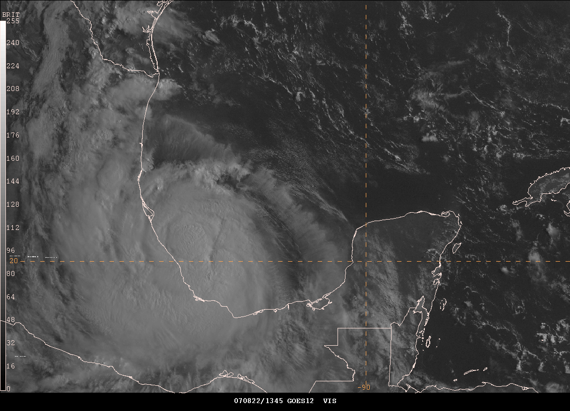
Noon Images - Cat 1 Dean
Special thanks this week to Jason Darnall for all of his tech support in keeping things running smoothly.
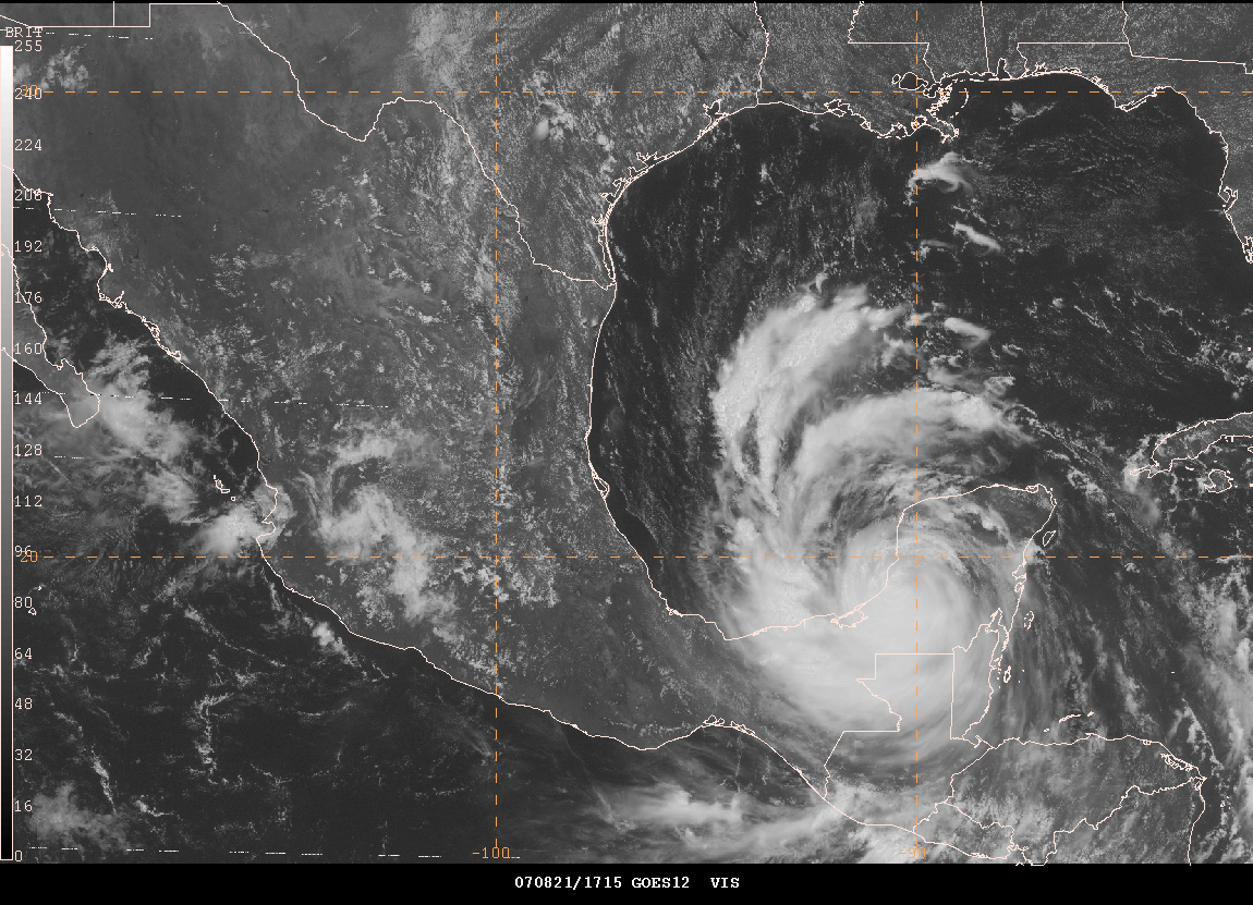
4:00 PM EDT - Dean Emerges into the Bay of Campeche...
Dean is a category one hurricane late this afternoon with winds of 80 mph. The storm continues to move towards the west at 20 mph. Dean will be very close to the coast of Mexico on Wednesday and will then move ashore. Dean may strengthen over the next 24 hours. Dean is expected to strike Mexico as a category 2 or 3 on the Saffir-Simpson scale.

4 PM CDT Satellite Images
Storm Chase Mike Theiss has posted some images from the Caribbean. You can view them here.
Floods kill 20 people across the Midwest...
Twenty weather-related deaths were reported with six in southeastern Minnesota, six deaths in Oklahoma, and eight in Texas. Rains also caused major flooding in Wisconsin. The remnants of Tropical Storm Erin caused widespread flooding from Texas into Oklahoma and Missouri. Moisture also spread northward being pulled into a second weather system. The extremely heavy rainfall triggered flash flooding. Reports out of Southeast Minnesota indicate some of the worst flooding in recent memory.
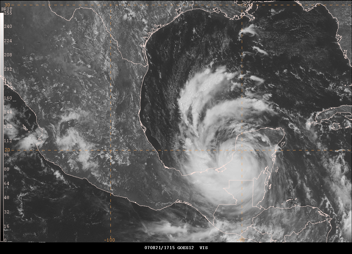
10:00 PM CDT - Dean in the Bay of Campeche...Category 1


10 PM CDT - Satellite Images - Eye is trying to reform
August 22, 2007
Hurricane Dean will make landfall once again on the Mexican Coast today. Thankfully he won't be as strong as the first time around. As of midnight, this morning, there have been no deaths reported in Mexico from Hurricane Dean. There is some uncertainty as to whether or not officials have been able to reach the hardest hit areas north of Chetumal. There will likely be more information later today concerning that region.
Meanwhile, record cold temperatures were felt across portions of New York yesterday. Glenn Falls, New York, recorded a low temperature of 39 degrees. This is the earliest recorded temperature in the 30s since records began in 1944. The previous record of 40 degrees was set back in 1977.
PUBLIC INFORMATION STATEMENT
NATIONAL WEATHER SERVICE ALBANY NY
524 PM EDT TUE AUG 21 2007
...GLENS FALLS RECORDS EARLIEST TEMPERATURE IN THE 30S...
A COLD AREA OF HIGH PRESSURE SITUATED OVER QUEBEC...ALONG WITH
MAINLY CLEAR SKIES AND LIGHT WINDS...ALLOWED TEMPERATURES TO DROP TO
A RECORD 39 DEGREES THIS MORNING AT GLENS FALLS FLOYD BENNETT
MEMORIAL AIRPORT. THIS BROKE THE PREVIOUS RECORD OF 40 DEGREES SET
IN 1977. THIS MORNINGS LOW OF 39 WAS ALSO THE EARLIEST IN THE SEASON
ON RECORD OF A TEMPERATURE IN THE 30S FOR GLENS FALLS. RECORDS IN
GLENS FALLS GO BACK TO 1944.
$$
FRUGIS
Who is in the mood for some fall colors? Early fall colors in Manitoba. Made me smile! I will be looking forward to more and more photos like this over the next few months!
The blog had almost 160000 hits in the last
five days. An incredible number. I had to look at the data
twice just to make sure I was reading it right. I guess Hurricane
Dean brought out all the weather enthusiasts. One wonders what the
rest of the season will bring. We are only on the fourth named
storm for the season. Long way to go. I was hoping to get at
least one chase in. We shall see how that works out. Then I
am going into winter mode!
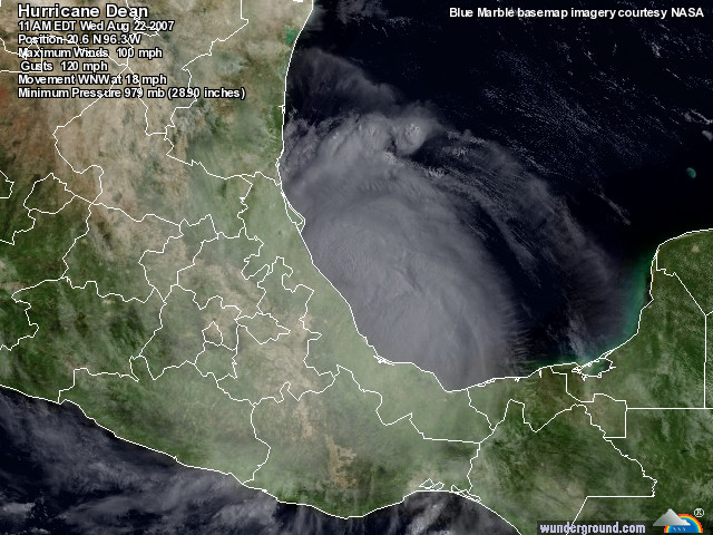
11 AM CDT Information on Hurricane Dean...
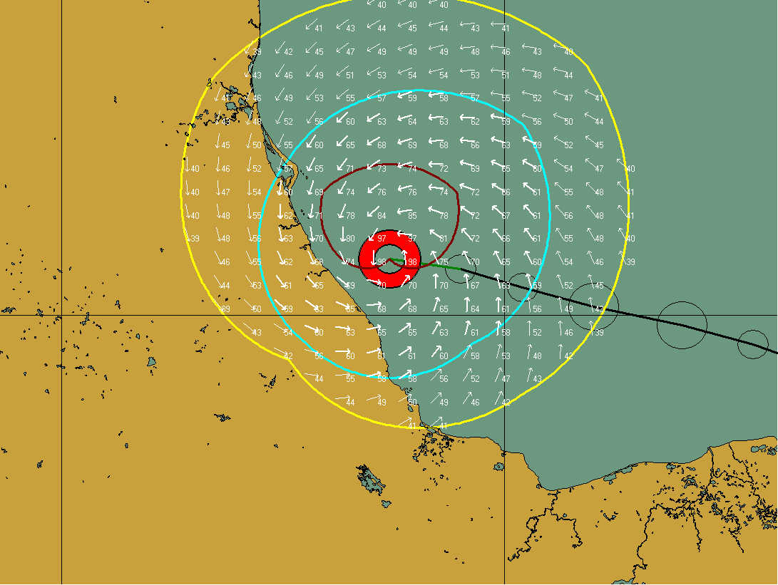
HurrTrak Deans Wind Field This Morning at 11 AM CDT
11 AM Images
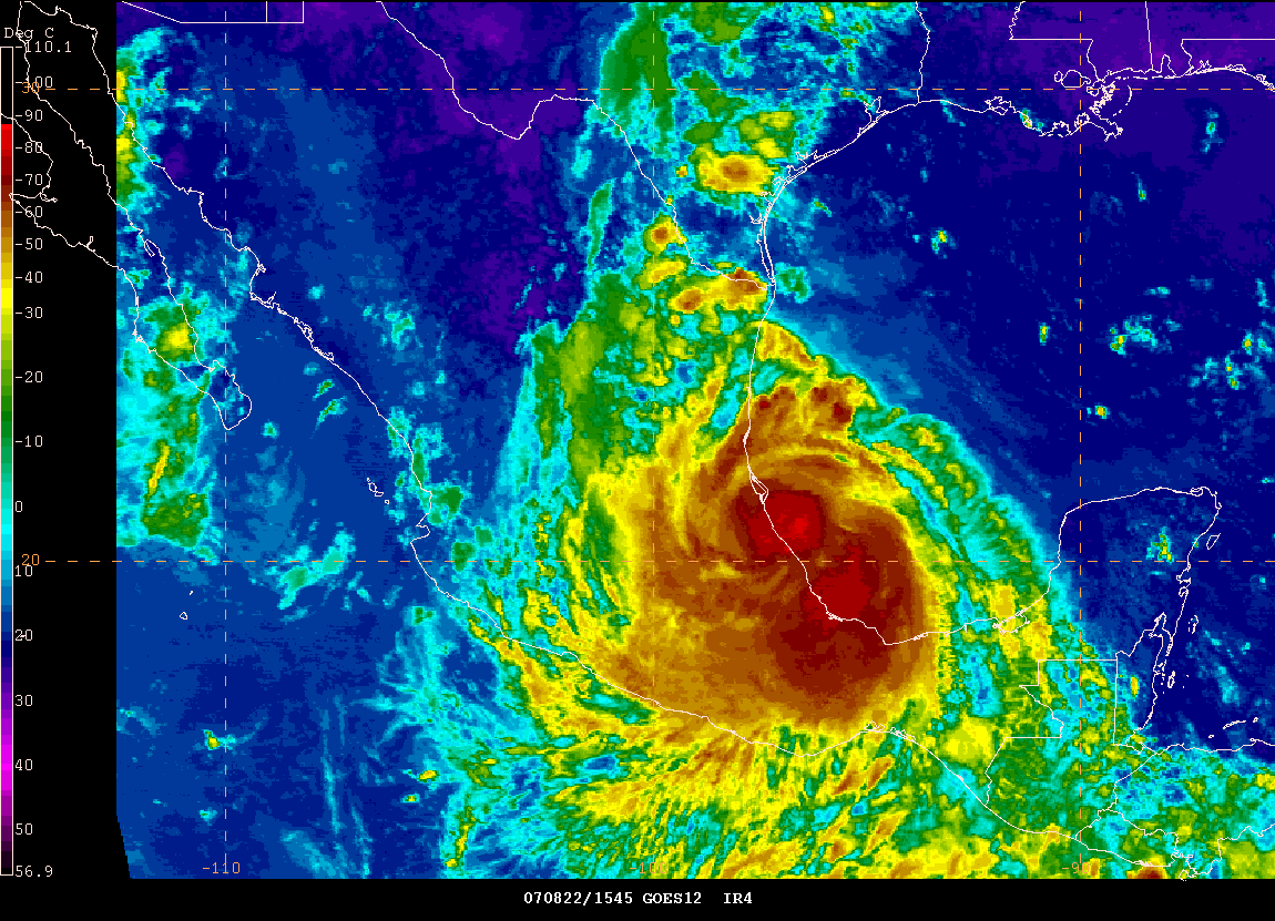
Hurricane Dean has reached category 2 strength as of 10 a.m. He will move ashore in the next few hours. Maximum sustained winds are now 100 miles per hour.


Dean moves ashore

Storm History from Wunderground
![]()
Entire path of Dean - HurrTrak Plot
![]()
Animation of Hurricane Dean with wind field - HurrTrak
WTNT64 KNHC 221646
TCUAT4
HURRICANE DEAN TROPICAL CYCLONE UPDATE
NWS TPC/NATIONAL HURRICANE CENTER MIAMI FL AL042007
1150 AM CDT WED AUG 22 2007
THE CENTER OF HURRICANE DEAN MADE LANDFALL IN MEXICO NEAR THE TOWN
OF TECOLUTLA...JUST EAST OF GUTIERREZ ZAMORA AND ABOUT 40 MILES
SOUTH-SOUTHEAST OF TUXPAN AT ABOUT 1130 AM CDT...1630 UTC. THE
ESTIMATED INTENSITY OF DEAN AT LANDFALL WAS 100 MPH...160
KPH....CATEGORY TWO ON THE SAFFIR-SIMPSON HURRICANE SCALE.
$$
FORECASTER FRANKLIN
UPDATE FROM HURRICANE CHASER JOSH MORGERMAN
Hi folks! I'm in the lobby of my hotel in Chetumal, about to leave to the airport to fly to Cancun. We have power again, which is cool.
When I get back to Playa Del Carmen this afternoon, I'll write a full report.
P.S. The storm seemed to peak around 5:20 am thru maybe 6:30 or 7 am, and I notice now-- as I read the thread-- that that seems to correlate well with what you guys were saying Re: the location of the eyewall.
Josh has also posted more information here about his adventure
A sample of his post...
"Dawn revealed a wild spectacle—complete urban pandemonium. Dynamite gusts blasted the spent shells of ragged trees. Clanking and smashing sounds cut through the wind’s shriek as windows broke and building wreckage fell onto the sidewalk. The street flooded and dirty water overflowed into the hotel lobby. Debris—including a huge water tank that had fallen from the hotel roof—floated down the street."
Turn the page for more weather
Home | About | News | Upcoming Events| Photo Gallery | Video | Links | Contact
All Photos are copyrighted by Beau Dodson and are used on this site with his permission. Any use other than authorized by them is against the law. If you wish to contact him regarding use of these photos, please e-mail me and I will forward it.