October 2008
October 04, 2008
Fall is in the air. Temperatures fell into the 40s last night...making for a chilly football game at Massac County (southern Illinois) High School.
It appears that the rather benign weather pattern will continue for a couple of more days. A storm system will pull into the central United States on Sunday. This will spark a few strong storms across Kansas, Oklahoma, and Texas.
This system will bring a chance for showers and thunderstorms into our region (west Kentucky and southern Illinois) by Tuesday into Wednesday. A few heavy storms are possible.
A chilly air mass could move into our region next weekend. Temperatures could dip down into the upper 30s or lower 40s by Sunday morning. Still a long way off, though.
- beau dodson
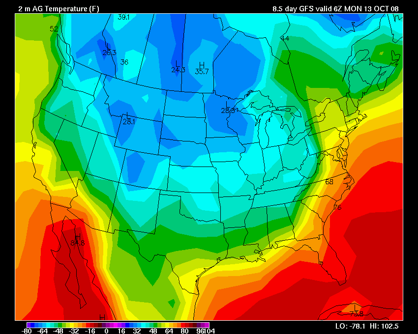
GFS Temp Forecast
October 14, 2008
Well, nothing exciting to report in the weather department. We did have some rain last week. Finally. Over an inch here in Paducah. Few claps of thunder as well.
The GFS was wrong, as usual, on the cold wave this past weekend. We were above normal in the temperature department. GFS has a cold bias and it should did show.
There are hints of a severe weather threat later next week and the week after. It is that time of the year, so I will be keeping an eye on the models.
No "real" hint of winter, though. At least not for our area.
Temperatures were in the 80s yesterday and today. Warm.
- beau dodson
October 21, 2008
Finally, a change in the weather pattern? It would appear so.
A storm system will take shape over the central United States over the next 24 hours. This system will close off on Thursday and move slowly through the Ohio Valley. Colder weather will spread into our region behind the occluded front. Temperatures will be in the 40s and 50s through Sunday. Much colder than it has been of late.
This will be the first round of chilly weather. A second and third round is expected next week. Models are indicating that temperatures could be as much as 20 degrees below normal across portions of the Missouri Valley.
Perhaps we will see our first hint of frost? Possibly.
The GFS even paints some snow across the Missouri Valley and then northward into the Plains. A bit soon to be talking about snow. Time will tell.
- beau dodson
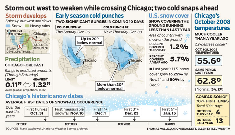
WGN Graphic
October 22, 2008
The storm system continues to develop over the central U.S. Blizzard warnings have even been issued for portions of Kansas. Always exciting to see snow showing up on the weather map!
Rain will spread into our region on Thursday and Thursday night. A brief period of heavy rain will be possible with the front. Can't rule out a clap of thunder.
Colder air will push into the region on Sunday and Monday. You can see the CAA on the 850 mb map below.
- beau dodson

Wednesday Morning Storm Winds Up
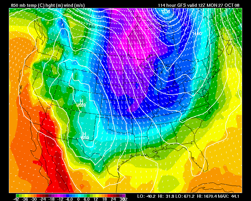
CAA On Monday - Cold air rushing into region
October 23, 2008
Rain! There has been some soaking rains across western Kentucky today. The rain started around 9 AM this morning and it is still raining as of 11 PM. So far we have picked up over 1.00" here in the City of Paducah.
You can see the cut off low on the 500 and 850mb map. Snow has fallen across portions of Kansas and Nebraska overnight. Windy conditions were also reported across northwest Kansas and southwest Nebraska with several gusts over 50 mph. This caused some blowing snow with reduced visibilities.
Colder air will push into the region on Sunday and Monday. We may have some scattered frost in the region. Low temperatures will fall into the 30s.
- beau dodson
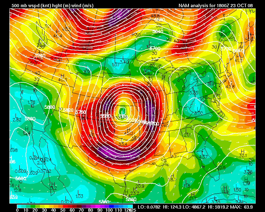
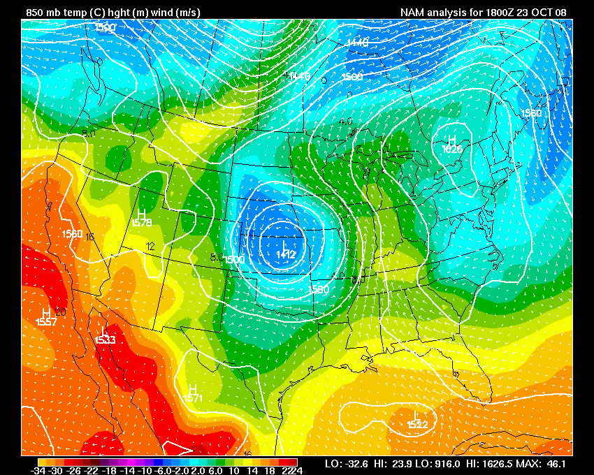
500 mb and 850 mb map.
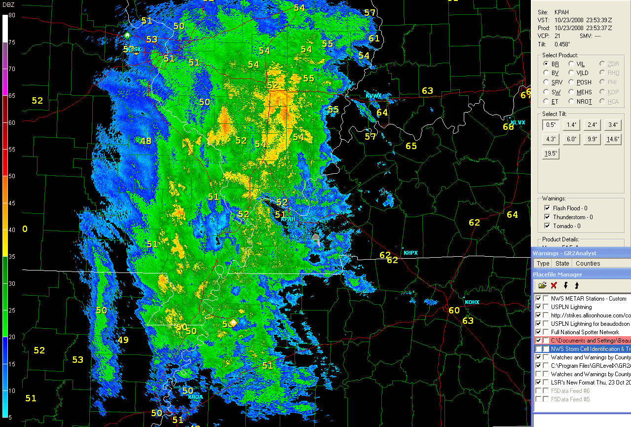
KPAH Radar - Evening
October 24, 2008
Visible satellite images today shows the big upper level low over the Missouri and Ohio Valleys. We had cooler weather today across western Kentucky and we are expecting our first frost on Monday night. Low temperatures should drop into the low to mid 30s across the region.
- beau dodson
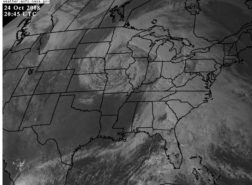
Visible Satellite Image

Temperature Departure Forecast - Monday
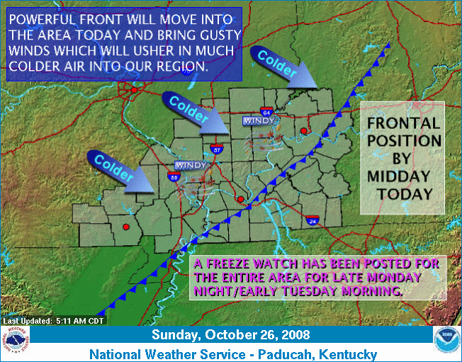
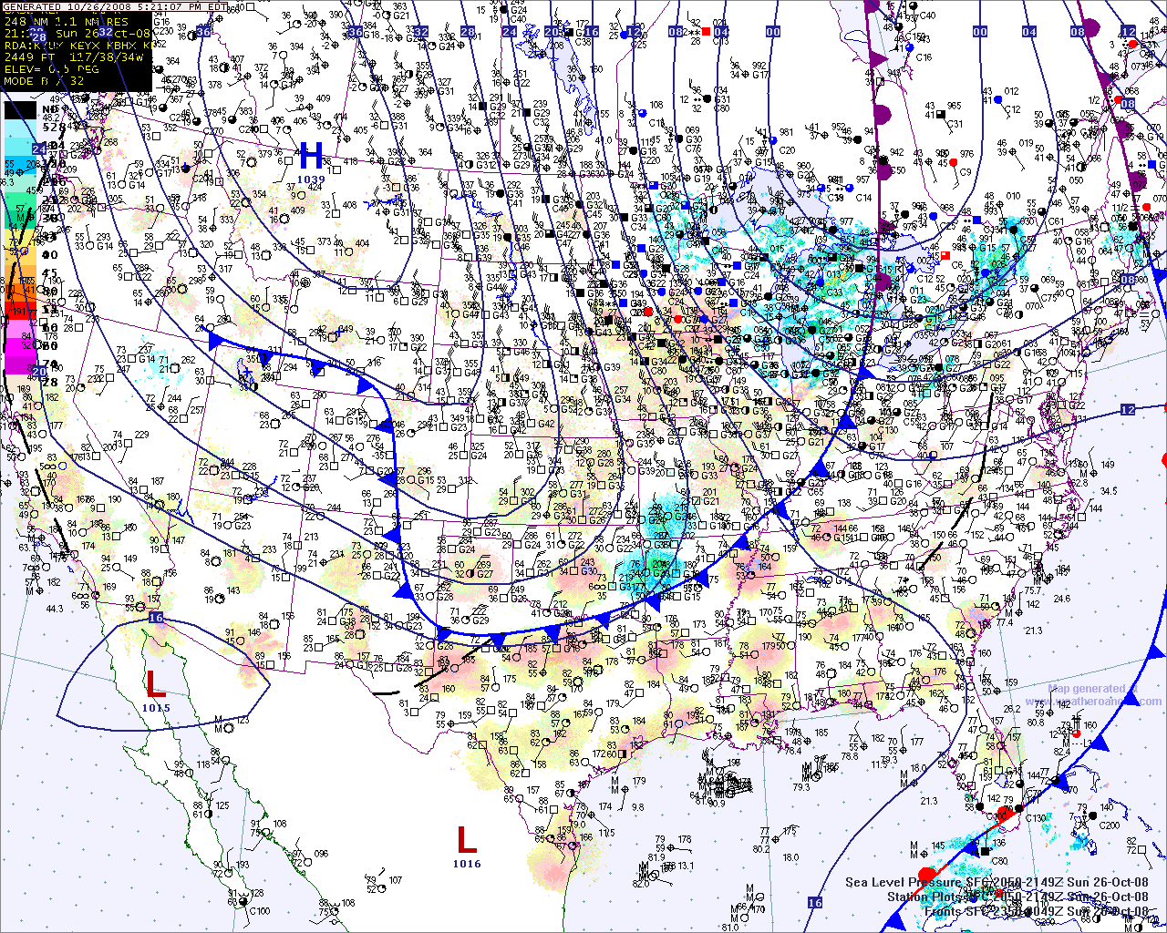
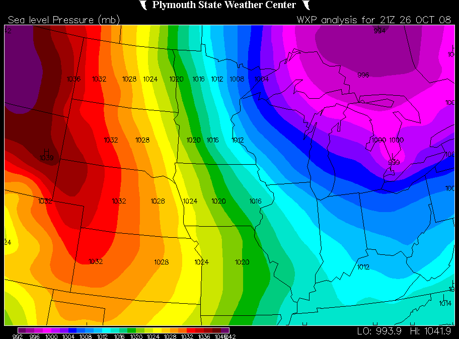
October 26, 2008
A beautiful day across west Kentucky. Fall has set in. The NWS has issued a freeze watch for Monday night. This watch will cover the entire tri-state area. This will be our first taste, since last spring, of low temperatures in the 20s and 30s.
Paducah, Kentucky NWS Statement...
  ...NEAR FREEZING TEMPERATURES EXPECTED LATE TONIGHT AND EARLY
MONDAY OVER PORTIONS OF SOUTHERN ILLINOIS AND SOUTHWEST INDIANA...
...GUSTY NORTHWEST WINDS EXPECTED THIS AFTERNOON AND EVENING...

  THE LEADING EDGE OF A SHARP COLD FRONT IS CURRENTLY PUSHING INTO
THE QUAD STATE REGION AND SHOULD MOVE COMPLETELY THROUGH THE AREA
BY EARLY THIS EVENING. THIS COLD FRONT WILL USHER IN UNSEASONABLY
COLD AIR INTO THE REGION THAT WILL PERSIST INTO MID WEEK.

  GUSTY NORTHWEST WINDS WILL DEVELOP ALONG AND BEHIND THE LEADING
EDGE OF THE COLD FRONT AS IT MOVES THROUGH THE REGION THIS
AFTERNOON AND THIS EVENING. GUSTY WINDS 20 TO 30 MPH CAN BE
EXPECTED...WITH LOCAL GUSTS NEAR 35 MPH POSSIBLE ALONG THE
INTERSTATE 64 CORRIDOR IN SOUTHERN ILLINOIS.

  THESE WIND GUSTS COULD BLOWN DOWN SOME WEAKENED TREES OR LARGE TREE
LIMBS DAMAGED BY THE SEVERE WINDS PRODUCED BY THE REMNANTS OF IKE
AS IT PASSED THROUGH THE AREA LAST MONTH.

  THE FRONTAL PASSAGE COULD ALSO PRODUCE NEAR FREEZING TEMPERATURES
FOR A SHORT DURATION LATE TONIGHT ALONG AND NORTH OF THE INTERSTATE
64 CORRIDOR. A PERSISTENT NORTHWEST WIND WILL LIKELY KEEP FROST
FROM FORMING TONIGHT.

  A GREATER LIKELIHOOD OF A WIDESPREAD FREEZE WILL COME LATE MONDAY
NIGHT INTO TUESDAY AS HIGH PRESSURE GETS CLOSER TO THE REGION.

$$

SMITH
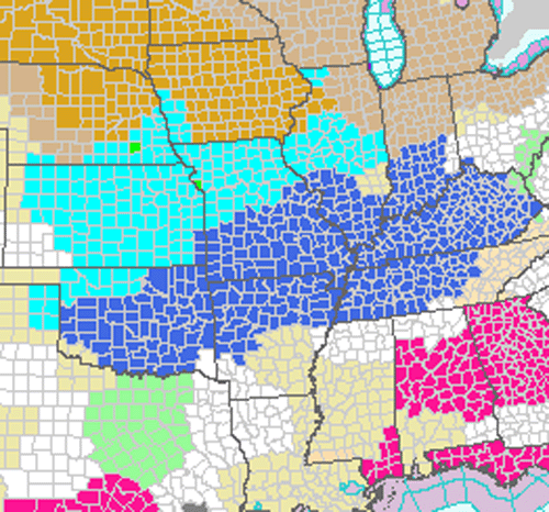
Dark blue area is the freeze watch. Light blue areas are freeze
warnings.

NWS Paducah - Weather Story and Current Temperatures

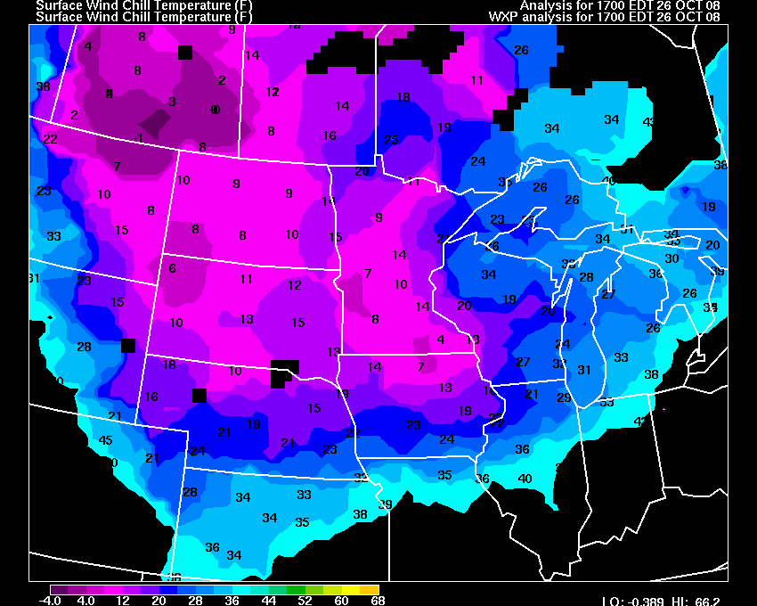
5 PM Wind Speed
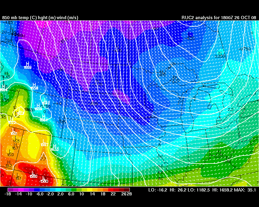
850 MB Map
Pressure Map - 5 PM
I am working on changing the format of this blog so that readers can subscribe to updates. I will be switching over to the WordPress format. Several people suggested this, so they can use Google Reader or other blog readers to receive updates.
- beau dodson
October 27, 2008
Check out the area of high pressure in the middle of the country! Pressure readings here in Paducah, Kentucky are above 30.40". We should see our first freeze tonight.
- beau dodson
High Pressure
October 30, 2008
There appears to be the potential for a strong storm system next week across the central portion of the United States. A bit early for specifics, but both the EC and GFS have been showing a strong signal for a significant storm during the Tuesday-Thursday time frame.
As far as the severe weather threat, there would be some concern as to moisture return in this area. Current dew point maps show that deeper moisture has been pushed way far south into the southern Gulf of Mexico. Wind fields appear to be strong, though. So, can't rule out the potential for some severe thunderstorms.
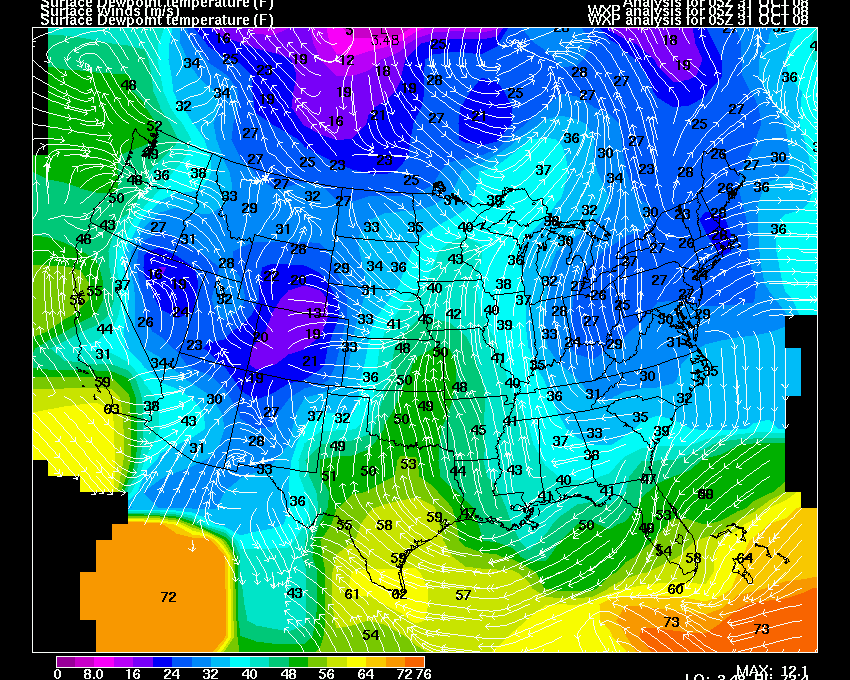
Dew point map
The GFS would indicate a tornado/wind potential across portions of the Missouri/Ohio Valley into the Great Lakes. So, something to keep an eye on. This storm would be in the long range and the models are most likely not handling moisture return and/or instability very well. Too early to know if either would be significant enough to trigger an outbreak.

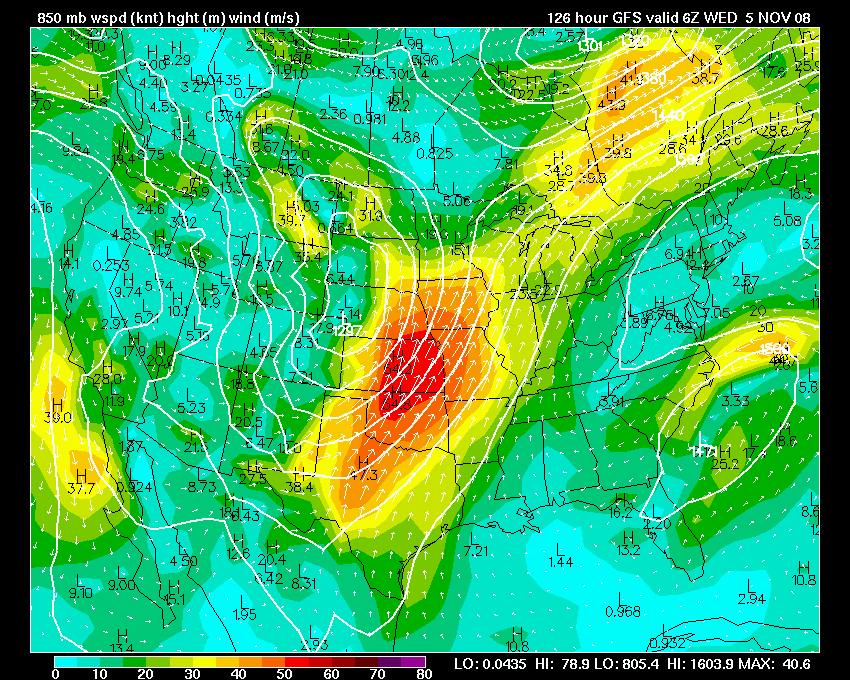

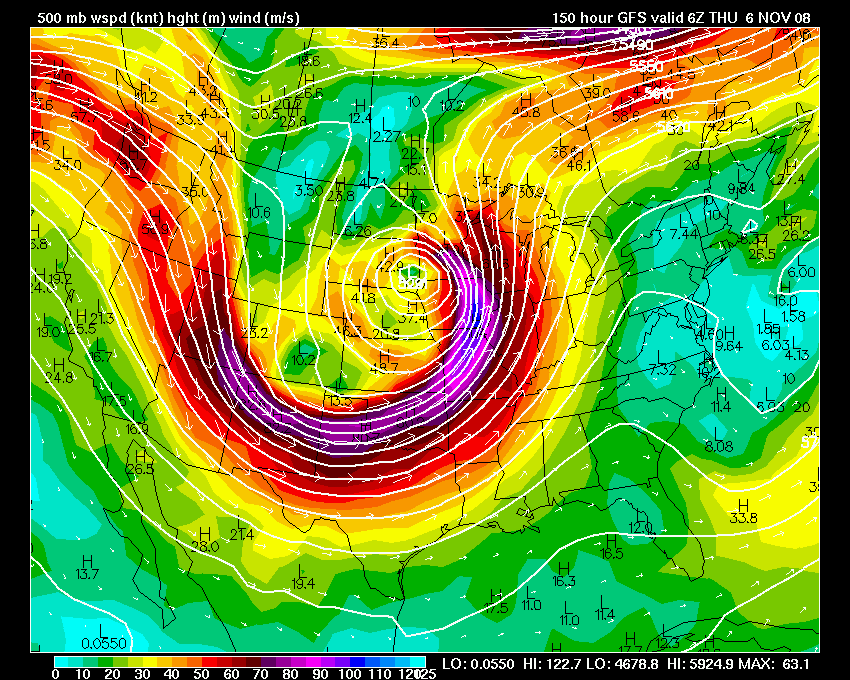
0z GFS Run - Thursday Night
The same storm would likely produce winter weather (blizzard?) across
portions of the northern Plains and Canada.
We had our first freeze over the last two nights. Paducah went down to 30 degrees on Tuesday night and 28 degrees last night.
- beau dodson
Home | About | News | Upcoming Events| Photo Gallery | Video | Links | Contact
All Photos are copyrighted by Beau Dodson (unless otherwise clearly stated) and are used on this site with his permission. Any use other than authorized by them is against the law. If you wish to contact him regarding use of these photos, please e-mail me and I will forward it.